EFI Mount Kent, East Falkland Island - Earthquake Result Viewer
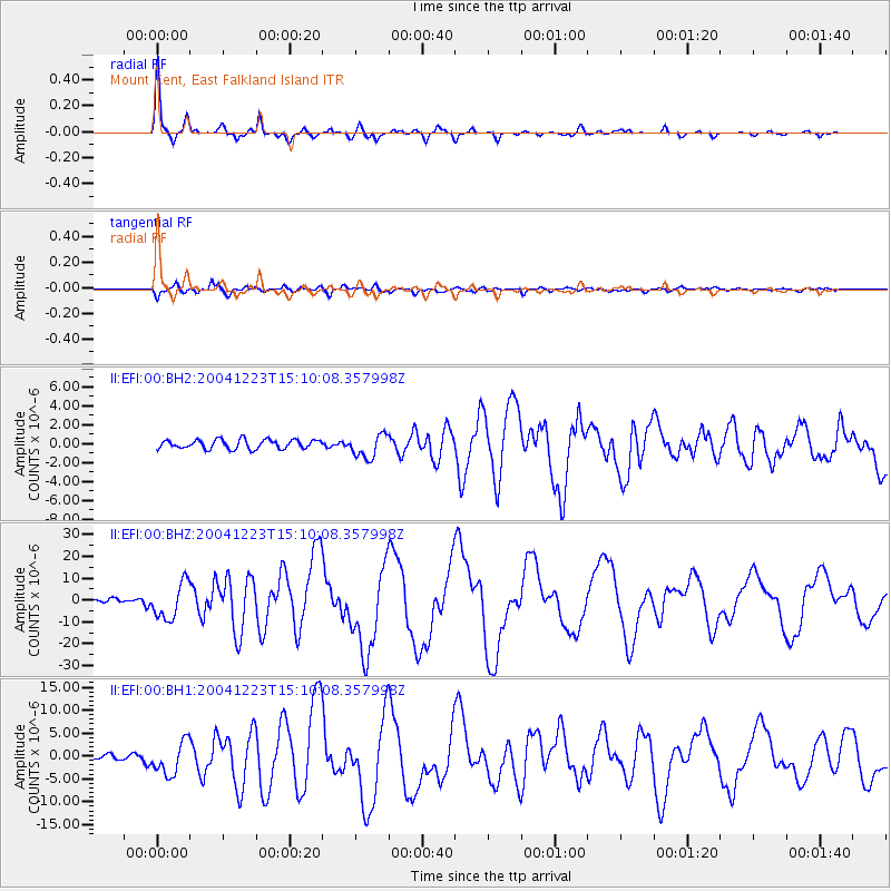
Earthquake location: North Of Macquarie Island
Earthquake latitude/longitude: -49.3/161.3
Earthquake time(UTC): 2004/12/23 (358) 14:59:04 GMT
Earthquake Depth: 10 km
Earthquake Magnitude: 8.0 MW, 6.5 MB, 7.7 MS, 8.1 MW
Earthquake Catalog/Contributor: NEIC PDE/NEIC PDE-M
Network: II Global Seismograph Network (GSN - IRIS/IDA)
Station: EFI Mount Kent, East Falkland Island
Lat/Lon: 51.68 S/58.06 W
Elevation: 110 m
Distance: 73.9 deg
Az: 155.709 deg
Baz: 205.618 deg
Ray Param: 0.052673362
Estimated Moho Depth: 37.75 km
Estimated Crust Vp/Vs: 1.75
Assumed Crust Vp: 6.472 km/s
Estimated Crust Vs: 3.693 km/s
Estimated Crust Poisson's Ratio: 0.26
Radial Match: 98.20844 %
Radial Bump: 275
Transverse Match: 93.42202 %
Transverse Bump: 400
SOD ConfigId: 590571
Insert Time: 2013-09-25 08:43:57.677 +0000
GWidth: 2.5
Max Bumps: 400
Tol: 0.001

Signal To Noise

ChannelStoNSTALTA
II:EFI:00:BHZ:20041223T15:10:08.357998Z16.0285938.239156E-65.140286E-7
II:EFI:00:BH1:20041223T15:10:08.357998Z10.4580073.517337E-63.3632958E-7
II:EFI:00:BH2:20041223T15:10:08.357998Z2.58233521.2481961E-64.8335943E-7
Arrivals
Ps4.5 SECOND
PpPs16 SECOND
PsPs/PpSs20 SECOND