MSEY Mahe, Seychelles - Earthquake Result Viewer
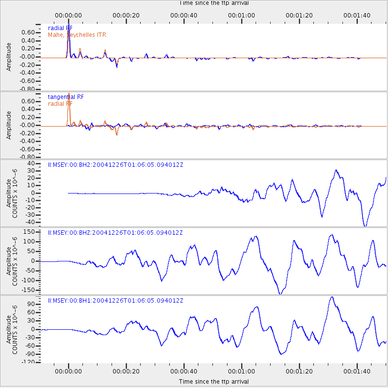
Earthquake location: Off W Coast Of Northern Sumatra
Earthquake latitude/longitude: 3.3/96.0
Earthquake time(UTC): 2004/12/26 (361) 00:58:53 GMT
Earthquake Depth: 30 km
Earthquake Magnitude: 8.2 MW, 7.0 MB, 8.8 MS, 9.0 MW
Earthquake Catalog/Contributor: NEIC PDE/NEIC PDE-M
Network: II Global Seismograph Network (GSN - IRIS/IDA)
Station: MSEY Mahe, Seychelles
Lat/Lon: 4.67 S/55.48 E
Elevation: 475 m
Distance: 41.2 deg
Az: 259.15 deg
Baz: 79.656 deg
Ray Param: 0.07386206
Estimated Moho Depth: 30.5 km
Estimated Crust Vp/Vs: 1.81
Assumed Crust Vp: 6.303 km/s
Estimated Crust Vs: 3.492 km/s
Estimated Crust Poisson's Ratio: 0.28
Radial Match: 98.98583 %
Radial Bump: 203
Transverse Match: 92.50288 %
Transverse Bump: 400
SOD ConfigId: 590571
Insert Time: 2013-09-25 08:45:35.033 +0000
GWidth: 2.5
Max Bumps: 400
Tol: 0.001

Signal To Noise

ChannelStoNSTALTA
II:MSEY:00:BHZ:20041226T01:06:05.094012Z7.11602976.506083E-69.142856E-7
II:MSEY:00:BH1:20041226T01:06:05.094012Z4.9067883.2495363E-66.622533E-7
II:MSEY:00:BH2:20041226T01:06:05.094012Z3.90915258.086024E-72.0684851E-7
Arrivals
Ps4.2 SECOND
PpPs13 SECOND
PsPs/PpSs17 SECOND