
TATO Taipei, Taiwan - Earthquake Result Viewer
| ||||||||||||||||||
| ||||||||||||||||||
| ||||||||||||||||||
|
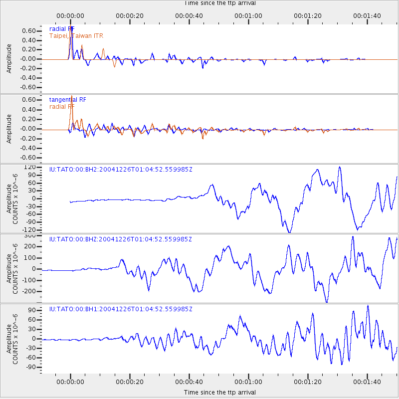
Signal To Noise
| Channel | StoN | STA | LTA |
| IU:TATO:00:BHZ:20041226T01:04:52.559985Z | 2.4337037 | 6.1887035E-6 | 2.542916E-6 |
| IU:TATO:00:BH1:20041226T01:04:52.559985Z | 1.402871 | 1.7823999E-6 | 1.2705372E-6 |
| IU:TATO:00:BH2:20041226T01:04:52.559985Z | 1.0943615 | 3.16778E-6 | 2.8946376E-6 |
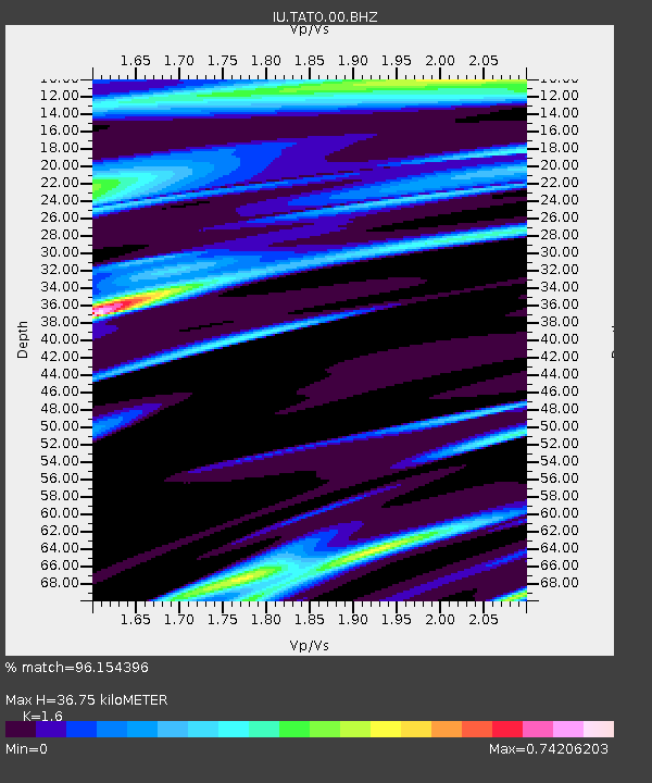
| Arrivals | |
| Ps | 3.8 SECOND |
| PpPs | 14 SECOND |
| PsPs/PpSs | 18 SECOND |

