You are here: Home > Network List > II - Global Seismograph Network (GSN - IRIS/IDA) Stations List
> Station MBAR Mbarara, Uganda > Earthquake Result Viewer
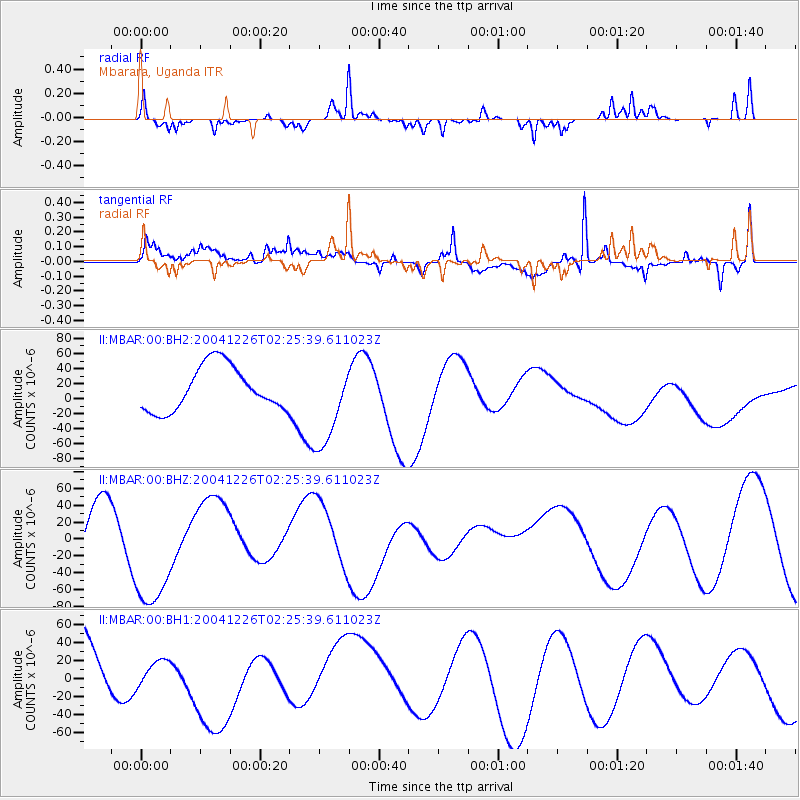
MBAR Mbarara, Uganda - Earthquake Result Viewer
*The percent match for this event was below the threshold and hence no stack was calculated.
| Earthquake location: |
Andaman Islands, India Region |
| Earthquake latitude/longitude: |
12.3/92.3 |
| Earthquake time(UTC): |
2004/12/26 (361) 02:15:49 GMT |
| Earthquake Depth: |
20 km |
| Earthquake Magnitude: |
5.7 MB |
| Earthquake Catalog/Contributor: |
NEIC PDE/NEIC PDE-M |
|
| Network: |
II Global Seismograph Network (GSN - IRIS/IDA) |
| Station: |
MBAR Mbarara, Uganda |
| Lat/Lon: |
0.60 S/30.74 E |
| Elevation: |
1390 m |
|
| Distance: |
62.4 deg |
| Az: |
262.82 deg |
| Baz: |
75.903 deg |
| Ray Param: |
$rayparam |
*The percent match for this event was below the threshold and hence was not used in the summary stack. |
|
| Radial Match: |
68.29731 % |
| Radial Bump: |
287 |
| Transverse Match: |
69.13594 % |
| Transverse Bump: |
400 |
| SOD ConfigId: |
590571 |
| Insert Time: |
2013-09-25 08:50:25.077 +0000 |
| GWidth: |
2.5 |
| Max Bumps: |
400 |
| Tol: |
0.001 |
|
Signal To Noise
| Channel | StoN | STA | LTA |
| II:MBAR:00:BHZ:20041226T02:25:39.611023Z | 1.3962878 | 7.117822E-5 | 5.0976752E-5 |
| II:MBAR:00:BH1:20041226T02:25:39.611023Z | 0.28677484 | 1.2457334E-5 | 4.3439424E-5 |
| II:MBAR:00:BH2:20041226T02:25:39.611023Z | 1.9817531 | 5.8128076E-5 | 2.9331644E-5 |
| Arrivals |
| Ps | |
| PpPs | |
| PsPs/PpSs | |


