You are here: Home > Network List > TA - USArray Transportable Network (new EarthScope stations) Stations List
> Station G59A Clarenceville, QC, USA > Earthquake Result Viewer
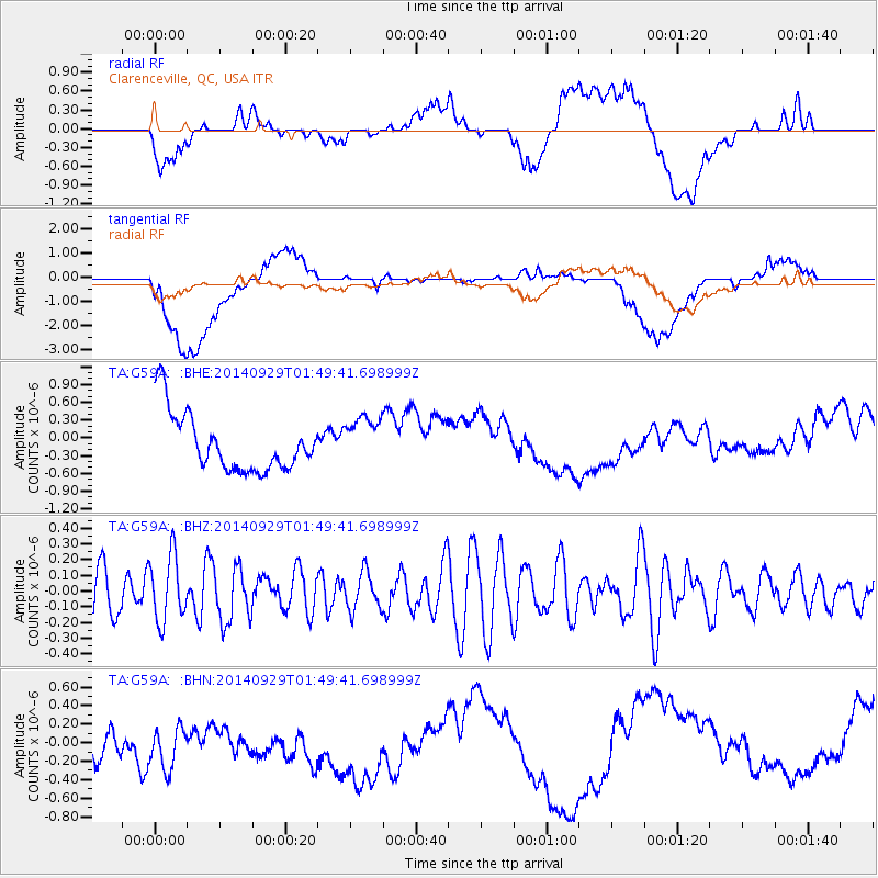
G59A Clarenceville, QC, USA - Earthquake Result Viewer
*The percent match for this event was below the threshold and hence no stack was calculated.
| Earthquake location: |
Eastern Caucasus |
| Earthquake latitude/longitude: |
41.1/47.9 |
| Earthquake time(UTC): |
2014/09/29 (272) 01:38:08 GMT |
| Earthquake Depth: |
15 km |
| Earthquake Magnitude: |
5.1 MW |
| Earthquake Catalog/Contributor: |
ISC/ISC |
|
| Network: |
TA USArray Transportable Network (new EarthScope stations) |
| Station: |
G59A Clarenceville, QC, USA |
| Lat/Lon: |
45.08 N/73.18 W |
| Elevation: |
36 m |
|
| Distance: |
79.3 deg |
| Az: |
321.887 deg |
| Baz: |
41.149 deg |
| Ray Param: |
$rayparam |
*The percent match for this event was below the threshold and hence was not used in the summary stack. |
|
| Radial Match: |
20.40219 % |
| Radial Bump: |
400 |
| Transverse Match: |
41.407932 % |
| Transverse Bump: |
400 |
| SOD ConfigId: |
3390531 |
| Insert Time: |
2019-04-14 06:23:37.866 +0000 |
| GWidth: |
2.5 |
| Max Bumps: |
400 |
| Tol: |
0.001 |
|
Signal To Noise
| Channel | StoN | STA | LTA |
| TA:G59A: :BHZ:20140929T01:49:41.698999Z | 1.6359748 | 2.086599E-7 | 1.275447E-7 |
| TA:G59A: :BHN:20140929T01:49:41.698999Z | 1.3429832 | 6.837542E-7 | 5.0913087E-7 |
| TA:G59A: :BHE:20140929T01:49:41.698999Z | 0.85576385 | 4.1913367E-7 | 4.897773E-7 |
| Arrivals |
| Ps | |
| PpPs | |
| PsPs/PpSs | |


