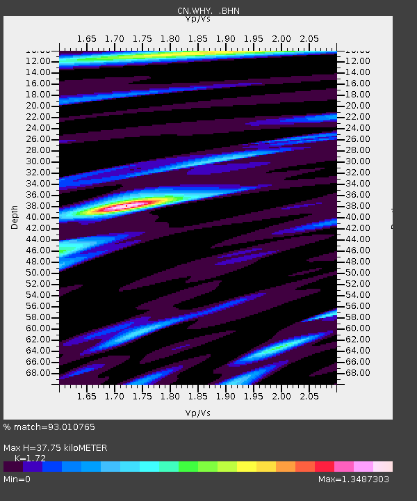
WHY Whitehorse, YT - Earthquake Result Viewer

Earthquake location: Southwestern Ryukyu Isl., Japan
Earthquake latitude/longitude: 24.2/125.1
Earthquake time(UTC): 2009/08/05 (217) 00:17:58 GMT
Earthquake Depth: 25 km
Earthquake Magnitude: 5.9 MB, 5.9 MS, 6.2 MW, 6.1 MW
Earthquake Catalog/Contributor: WHDF/NEIC
Network: CN Canadian National Seismograph Network
Station: WHY Whitehorse, YT
Lat/Lon: 60.66 N/134.88 W
Elevation: 1292 m
Distance: 73.9 deg
Az: 30.313 deg
Baz: 290.679 deg
Ray Param: 0.05265059
Estimated Moho Depth: 37.75 km
Estimated Crust Vp/Vs: 1.72
Assumed Crust Vp: 6.419 km/s
Estimated Crust Vs: 3.732 km/s
Estimated Crust Poisson's Ratio: 0.24
Radial Match: 93.010765 %
Radial Bump: 400
Transverse Match: 89.71293 %
Transverse Bump: 400
SOD ConfigId: 2622
Insert Time: 2010-02-27 07:54:47.470 +0000
GWidth: 2.5
Max Bumps: 400
Tol: 0.001

Signal To Noise

ChannelStoNSTALTA
CN:WHY: :BHN:20090805T00:29:00.525017Z26.4513951.2083494E-64.568188E-8
CN:WHY: :BHE:20090805T00:29:00.525017Z5.0216142.3199351E-74.6198995E-8
CN:WHY: :BHZ:20090805T00:29:00.525017Z4.90115073.978588E-78.117661E-8
Arrivals
Ps4.4 SECOND
PpPs15 SECOND
PsPs/PpSs20 SECOND