You are here: Home > Network List > TA - USArray Transportable Network (new EarthScope stations) Stations List
> Station X43A Marvell, AR, USA > Earthquake Result Viewer
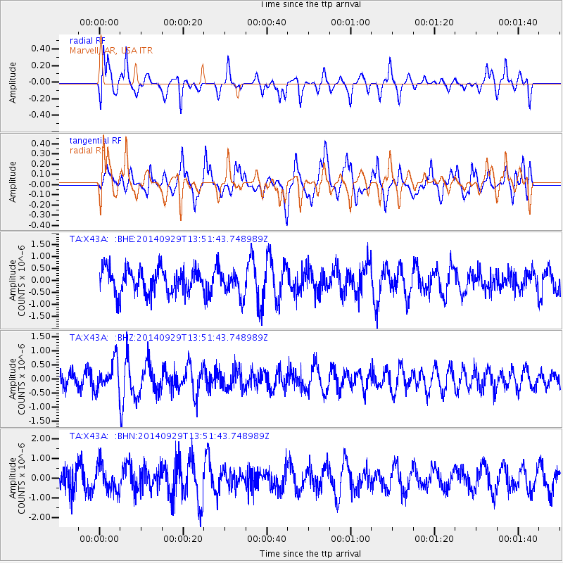
X43A Marvell, AR, USA - Earthquake Result Viewer
*The percent match for this event was below the threshold and hence no stack was calculated.
| Earthquake location: |
Iceland |
| Earthquake latitude/longitude: |
64.5/-17.3 |
| Earthquake time(UTC): |
2014/09/29 (272) 13:43:01 GMT |
| Earthquake Depth: |
10 km |
| Earthquake Magnitude: |
5.6 MWW, 5.5 MWC |
| Earthquake Catalog/Contributor: |
NEIC PDE/NEIC COMCAT |
|
| Network: |
TA USArray Transportable Network (new EarthScope stations) |
| Station: |
X43A Marvell, AR, USA |
| Lat/Lon: |
34.52 N/90.88 W |
| Elevation: |
53 m |
|
| Distance: |
52.4 deg |
| Az: |
272.423 deg |
| Baz: |
31.576 deg |
| Ray Param: |
$rayparam |
*The percent match for this event was below the threshold and hence was not used in the summary stack. |
|
| Radial Match: |
42.721226 % |
| Radial Bump: |
335 |
| Transverse Match: |
40.27143 % |
| Transverse Bump: |
376 |
| SOD ConfigId: |
3390531 |
| Insert Time: |
2019-04-14 06:33:37.876 +0000 |
| GWidth: |
2.5 |
| Max Bumps: |
400 |
| Tol: |
0.001 |
|
Signal To Noise
| Channel | StoN | STA | LTA |
| TA:X43A: :BHZ:20140929T13:51:43.748989Z | 1.7804339 | 5.265655E-7 | 2.9575122E-7 |
| TA:X43A: :BHN:20140929T13:51:43.748989Z | 0.9203055 | 6.794246E-7 | 7.382598E-7 |
| TA:X43A: :BHE:20140929T13:51:43.748989Z | 0.95632666 | 4.8483605E-7 | 5.069774E-7 |
| Arrivals |
| Ps | |
| PpPs | |
| PsPs/PpSs | |


