WHY Whitehorse, YT - Earthquake Result Viewer
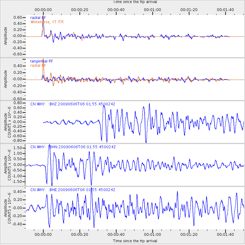
Earthquake location: Near East Coast Of Honshu, Japan
Earthquake latitude/longitude: 35.5/140.9
Earthquake time(UTC): 2009/06/06 (157) 05:52:43 GMT
Earthquake Depth: 34 km
Earthquake Magnitude: 5.8 MB, 5.4 MS, 5.8 MW, 5.7 MW
Earthquake Catalog/Contributor: WHDF/NEIC
Network: CN Canadian National Seismograph Network
Station: WHY Whitehorse, YT
Lat/Lon: 60.66 N/134.88 W
Elevation: 1292 m
Distance: 57.1 deg
Az: 35.713 deg
Baz: 284.692 deg
Ray Param: 0.06366132
Estimated Moho Depth: 10.0 km
Estimated Crust Vp/Vs: 1.91
Assumed Crust Vp: 6.419 km/s
Estimated Crust Vs: 3.352 km/s
Estimated Crust Poisson's Ratio: 0.31
Radial Match: 93.83882 %
Radial Bump: 400
Transverse Match: 83.090164 %
Transverse Bump: 400
SOD ConfigId: 2648
Insert Time: 2010-02-27 07:56:15.961 +0000
GWidth: 2.5
Max Bumps: 400
Tol: 0.001

Signal To Noise

ChannelStoNSTALTA
CN:WHY: :BHN:20090606T06:01:55.450024Z20.6799471.0054846E-64.862124E-8
CN:WHY: :BHE:20090606T06:01:55.450024Z3.7827342.2110825E-75.845197E-8
CN:WHY: :BHZ:20090606T06:01:55.450024Z8.4316884.248496E-75.038725E-8
Arrivals
Ps1.5 SECOND
PpPs4.3 SECOND
PsPs/PpSs5.8 SECOND