You are here: Home > Network List > II - Global Seismograph Network (GSN - IRIS/IDA) Stations List
> Station MBAR Mbarara, Uganda > Earthquake Result Viewer
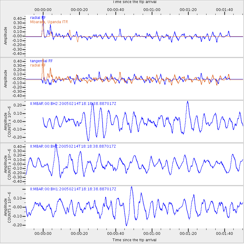
MBAR Mbarara, Uganda - Earthquake Result Viewer
*The percent match for this event was below the threshold and hence no stack was calculated.
| Earthquake location: |
Leeward Islands |
| Earthquake latitude/longitude: |
15.8/-61.7 |
| Earthquake time(UTC): |
2005/02/14 (045) 18:05:59 GMT |
| Earthquake Depth: |
12 km |
| Earthquake Magnitude: |
5.6 MB, 5.5 MS, 5.9 MW, 5.9 MW |
| Earthquake Catalog/Contributor: |
WHDF/NEIC |
|
| Network: |
II Global Seismograph Network (GSN - IRIS/IDA) |
| Station: |
MBAR Mbarara, Uganda |
| Lat/Lon: |
0.60 S/30.74 E |
| Elevation: |
1390 m |
|
| Distance: |
92.6 deg |
| Az: |
89.905 deg |
| Baz: |
285.664 deg |
| Ray Param: |
$rayparam |
*The percent match for this event was below the threshold and hence was not used in the summary stack. |
|
| Radial Match: |
55.767513 % |
| Radial Bump: |
400 |
| Transverse Match: |
47.48918 % |
| Transverse Bump: |
400 |
| SOD ConfigId: |
590571 |
| Insert Time: |
2013-09-25 10:42:07.089 +0000 |
| GWidth: |
2.5 |
| Max Bumps: |
400 |
| Tol: |
0.001 |
|
Signal To Noise
| Channel | StoN | STA | LTA |
| II:MBAR:00:BHZ:20050214T18:18:38.887017Z | 1.2910329 | 1.0724171E-7 | 8.3066595E-8 |
| II:MBAR:00:BH1:20050214T18:18:38.887017Z | 0.40174985 | 2.2878732E-8 | 5.6947705E-8 |
| II:MBAR:00:BH2:20050214T18:18:38.887017Z | 2.3542314 | 1.3737775E-7 | 5.835355E-8 |
| Arrivals |
| Ps | |
| PpPs | |
| PsPs/PpSs | |


