MSEY Mahe, Seychelles - Earthquake Result Viewer
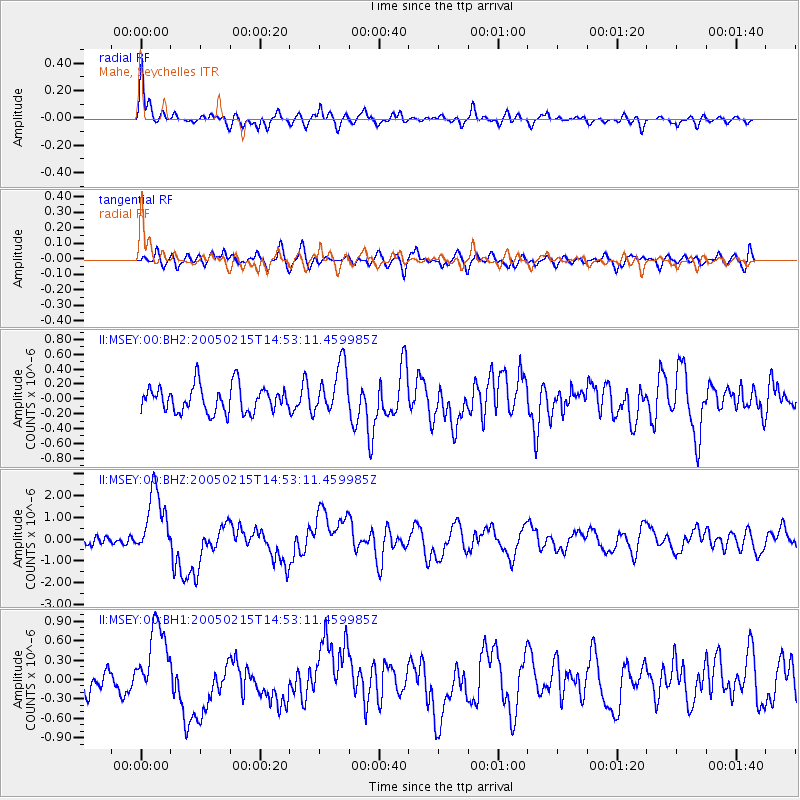
Earthquake location: Talaud Islands, Indonesia
Earthquake latitude/longitude: 4.8/126.4
Earthquake time(UTC): 2005/02/15 (046) 14:42:25 GMT
Earthquake Depth: 40 km
Earthquake Magnitude: 6.1 MB, 6.0 MS, 6.6 MW, 6.4 MW
Earthquake Catalog/Contributor: WHDF/NEIC
Network: II Global Seismograph Network (GSN - IRIS/IDA)
Station: MSEY Mahe, Seychelles
Lat/Lon: 4.67 S/55.48 E
Elevation: 475 m
Distance: 71.5 deg
Az: 263.492 deg
Baz: 83.434 deg
Ray Param: 0.054234054
Estimated Moho Depth: 35.0 km
Estimated Crust Vp/Vs: 1.95
Assumed Crust Vp: 6.303 km/s
Estimated Crust Vs: 3.228 km/s
Estimated Crust Poisson's Ratio: 0.32
Radial Match: 86.986595 %
Radial Bump: 400
Transverse Match: 56.723175 %
Transverse Bump: 400
SOD ConfigId: 590571
Insert Time: 2013-09-25 10:43:48.317 +0000
GWidth: 2.5
Max Bumps: 400
Tol: 0.001

Signal To Noise

ChannelStoNSTALTA
II:MSEY:00:BHZ:20050215T14:53:11.459985Z7.2694151.5251015E-62.0979701E-7
II:MSEY:00:BH1:20050215T14:53:11.459985Z4.3094086.097044E-71.4148216E-7
II:MSEY:00:BH2:20050215T14:53:11.459985Z1.87729913.3378956E-71.7780307E-7
Arrivals
Ps5.5 SECOND
PpPs16 SECOND
PsPs/PpSs21 SECOND