You are here: Home > Network List > IU - Global Seismograph Network (GSN - IRIS/USGS) Stations List
> Station RAR Rarotonga, Cook Islands > Earthquake Result Viewer
RAR Rarotonga, Cook Islands - Earthquake Result Viewer
*The percent match for this event was below the threshold and hence no stack was calculated.
| Earthquake location: |
Salta Province, Argentina |
| Earthquake latitude/longitude: |
-25.0/-63.5 |
| Earthquake time(UTC): |
2005/03/21 (080) 12:23:54 GMT |
| Earthquake Depth: |
579 km |
| Earthquake Magnitude: |
6.1 MB, 6.9 MW, 6.9 MW |
| Earthquake Catalog/Contributor: |
WHDF/NEIC |
|
| Network: |
IU Global Seismograph Network (GSN - IRIS/USGS) |
| Station: |
RAR Rarotonga, Cook Islands |
| Lat/Lon: |
21.21 S/159.77 W |
| Elevation: |
28 m |
|
| Distance: |
86.7 deg |
| Az: |
248.278 deg |
| Baz: |
115.371 deg |
| Ray Param: |
$rayparam |
*The percent match for this event was below the threshold and hence was not used in the summary stack. |
|
| Radial Match: |
63.4276 % |
| Radial Bump: |
318 |
| Transverse Match: |
65.4415 % |
| Transverse Bump: |
400 |
| SOD ConfigId: |
590571 |
| Insert Time: |
2013-09-25 11:39:32.629 +0000 |
| GWidth: |
2.5 |
| Max Bumps: |
400 |
| Tol: |
0.001 |
|
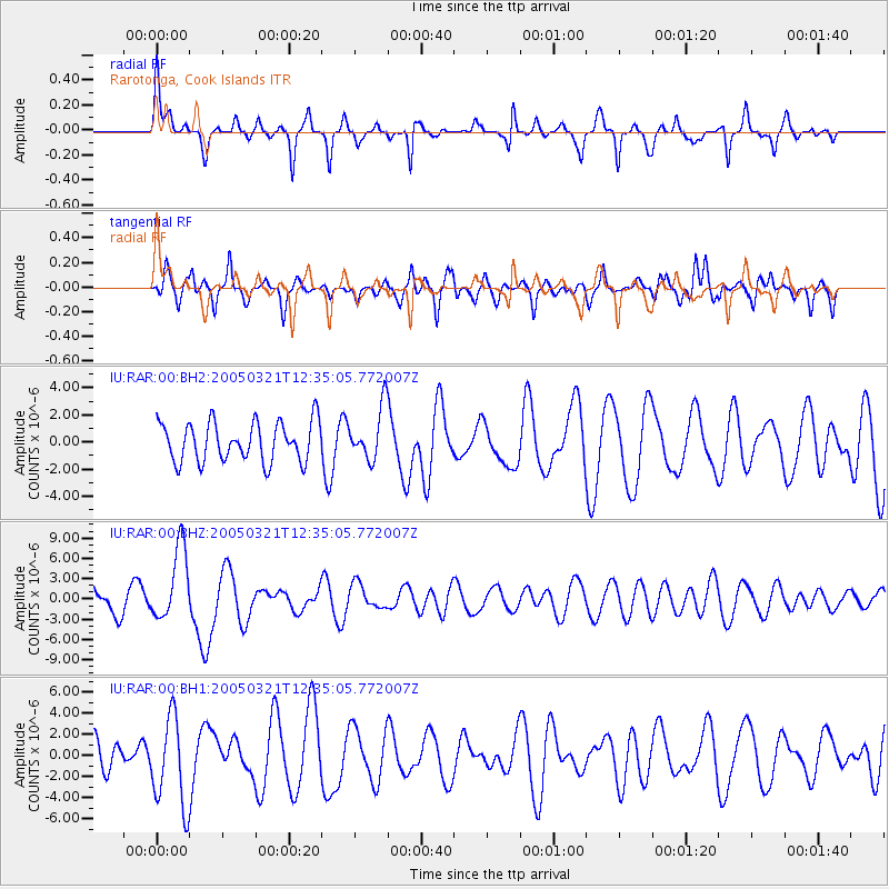
Signal To Noise
| Channel | StoN | STA | LTA |
| IU:RAR:00:BHZ:20050321T12:35:05.772007Z | 2.644098 | 5.4656653E-6 | 2.067119E-6 |
| IU:RAR:00:BH1:20050321T12:35:05.772007Z | 1.8105245 | 4.2220877E-6 | 2.3319694E-6 |
| IU:RAR:00:BH2:20050321T12:35:05.772007Z | 1.345532 | 1.9391844E-6 | 1.4412027E-6 |
| Arrivals |
| Ps | |
| PpPs | |
| PsPs/PpSs | |


