
MSEY Mahe, Seychelles - Earthquake Result Viewer
| ||||||||||||||||||
| ||||||||||||||||||
| ||||||||||||||||||
|
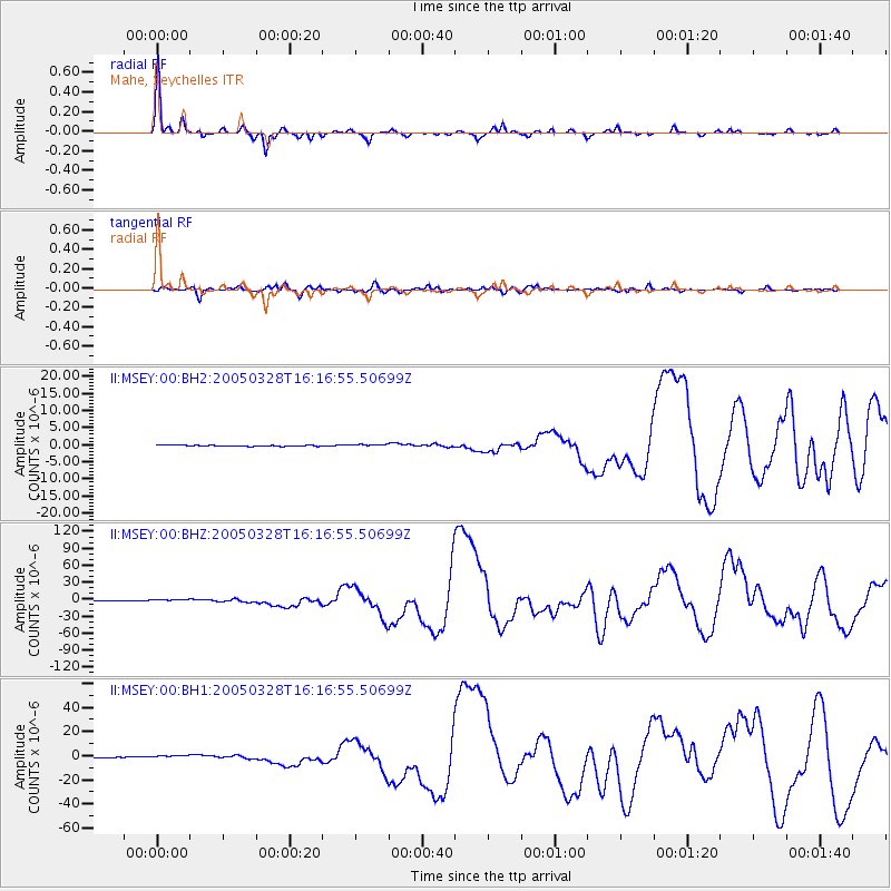
Signal To Noise
| Channel | StoN | STA | LTA |
| II:MSEY:00:BHZ:20050328T16:16:55.50699Z | 3.9492402 | 1.8450266E-6 | 4.671852E-7 |
| II:MSEY:00:BH1:20050328T16:16:55.50699Z | 3.5796587 | 1.2969244E-6 | 3.6230392E-7 |
| II:MSEY:00:BH2:20050328T16:16:55.50699Z | 2.0536363 | 3.2932292E-7 | 1.6036088E-7 |
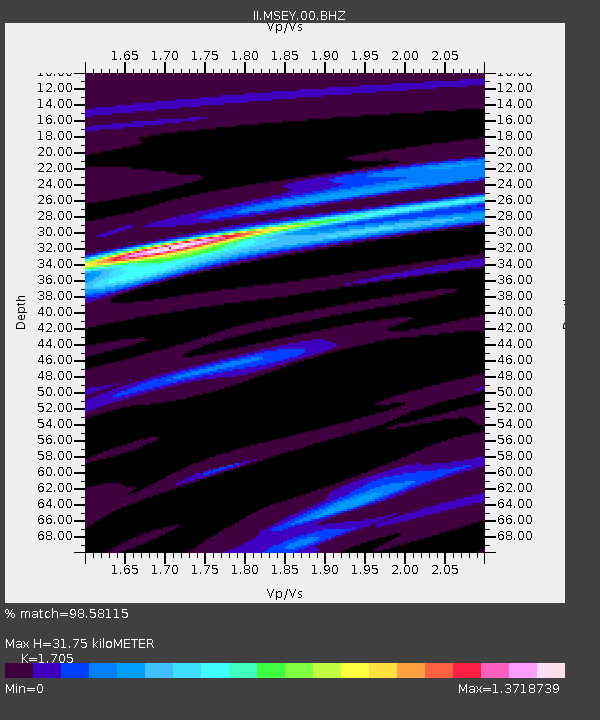
| Arrivals | |
| Ps | 3.8 SECOND |
| PpPs | 13 SECOND |
| PsPs/PpSs | 17 SECOND |

