
MSEY Mahe, Seychelles - Earthquake Result Viewer
| ||||||||||||||||||
| ||||||||||||||||||
| ||||||||||||||||||
|
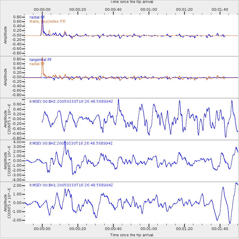
Signal To Noise
| Channel | StoN | STA | LTA |
| II:MSEY:00:BHZ:20050330T16:26:48.568994Z | 5.271598 | 1.1207289E-6 | 2.1259757E-7 |
| II:MSEY:00:BH1:20050330T16:26:48.568994Z | 3.1932676 | 6.132861E-7 | 1.9205596E-7 |
| II:MSEY:00:BH2:20050330T16:26:48.568994Z | 1.2191534 | 2.3984157E-7 | 1.9672797E-7 |
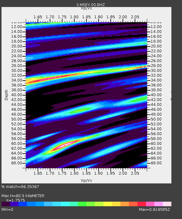
| Arrivals | |
| Ps | 7.8 SECOND |
| PpPs | 25 SECOND |
| PsPs/PpSs | 33 SECOND |

