You are here: Home > Network List > IU - Global Seismograph Network (GSN - IRIS/USGS) Stations List
> Station RSSD Black Hills, South Dakota, USA > Earthquake Result Viewer
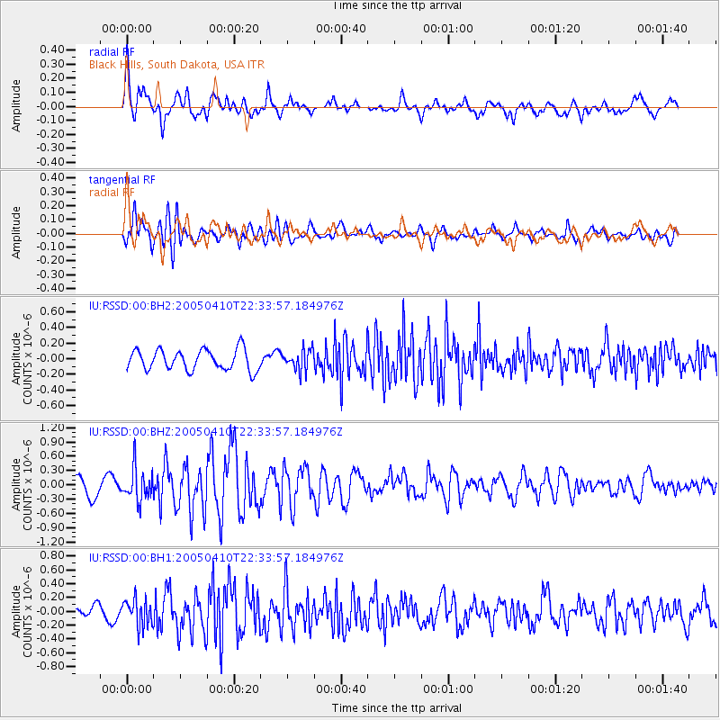
RSSD Black Hills, South Dakota, USA - Earthquake Result Viewer
*The percent match for this event was below the threshold and hence no stack was calculated.
| Earthquake location: |
Near East Coast Of Honshu, Japan |
| Earthquake latitude/longitude: |
35.6/140.4 |
| Earthquake time(UTC): |
2005/04/10 (100) 22:22:15 GMT |
| Earthquake Depth: |
43 km |
| Earthquake Magnitude: |
6.1 MB, 5.4 MS, 6.0 MW, 6.0 MW |
| Earthquake Catalog/Contributor: |
WHDF/NEIC |
|
| Network: |
IU Global Seismograph Network (GSN - IRIS/USGS) |
| Station: |
RSSD Black Hills, South Dakota, USA |
| Lat/Lon: |
44.12 N/104.04 W |
| Elevation: |
2060 m |
|
| Distance: |
81.4 deg |
| Az: |
41.074 deg |
| Baz: |
311.977 deg |
| Ray Param: |
$rayparam |
*The percent match for this event was below the threshold and hence was not used in the summary stack. |
|
| Radial Match: |
76.56246 % |
| Radial Bump: |
400 |
| Transverse Match: |
68.00748 % |
| Transverse Bump: |
400 |
| SOD ConfigId: |
590571 |
| Insert Time: |
2013-09-25 12:12:58.242 +0000 |
| GWidth: |
2.5 |
| Max Bumps: |
400 |
| Tol: |
0.001 |
|
Signal To Noise
| Channel | StoN | STA | LTA |
| IU:RSSD:00:BHZ:20050410T22:33:57.184976Z | 1.670028 | 3.4072818E-7 | 2.0402544E-7 |
| IU:RSSD:00:BH1:20050410T22:33:57.184976Z | 1.5197263 | 1.9666257E-7 | 1.2940657E-7 |
| IU:RSSD:00:BH2:20050410T22:33:57.184976Z | 1.0094606 | 1.3213804E-7 | 1.3089965E-7 |
| Arrivals |
| Ps | |
| PpPs | |
| PsPs/PpSs | |


