MSEY Mahe, Seychelles - Earthquake Result Viewer
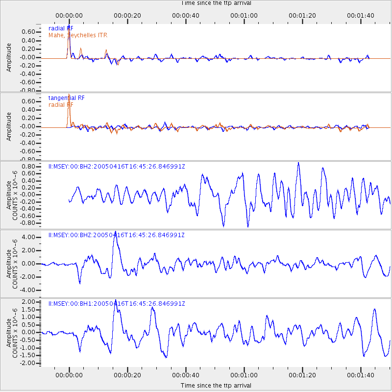
Earthquake location: Northern Sumatra, Indonesia
Earthquake latitude/longitude: 1.8/97.7
Earthquake time(UTC): 2005/04/16 (106) 16:38:03 GMT
Earthquake Depth: 31 km
Earthquake Magnitude: 6.0 MB, 6.2 MS, 6.4 MW, 6.3 MW
Earthquake Catalog/Contributor: WHDF/NEIC
Network: II Global Seismograph Network (GSN - IRIS/IDA)
Station: MSEY Mahe, Seychelles
Lat/Lon: 4.67 S/55.48 E
Elevation: 475 m
Distance: 42.6 deg
Az: 261.16 deg
Baz: 82.257 deg
Ray Param: 0.073000126
Estimated Moho Depth: 31.25 km
Estimated Crust Vp/Vs: 1.81
Assumed Crust Vp: 6.303 km/s
Estimated Crust Vs: 3.477 km/s
Estimated Crust Poisson's Ratio: 0.28
Radial Match: 84.920616 %
Radial Bump: 241
Transverse Match: 67.73813 %
Transverse Bump: 400
SOD ConfigId: 590571
Insert Time: 2013-09-25 12:26:08.064 +0000
GWidth: 2.5
Max Bumps: 400
Tol: 0.001

Signal To Noise

ChannelStoNSTALTA
II:MSEY:00:BHZ:20050416T16:45:26.846991Z7.37850051.0124752E-61.3721964E-7
II:MSEY:00:BH1:20050416T16:45:26.846991Z6.10351854.5600748E-77.471223E-8
II:MSEY:00:BH2:20050416T16:45:26.846991Z1.52231062.1200336E-71.3926419E-7
Arrivals
Ps4.3 SECOND
PpPs13 SECOND
PsPs/PpSs17 SECOND