MBAR Mbarara, Uganda - Earthquake Result Viewer
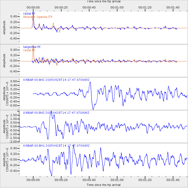
Earthquake location: Northern Sumatra, Indonesia
Earthquake latitude/longitude: 2.1/96.8
Earthquake time(UTC): 2005/04/28 (118) 14:07:33 GMT
Earthquake Depth: 22 km
Earthquake Magnitude: 5.9 MB, 6.2 MS, 6.3 MW, 6.2 MW
Earthquake Catalog/Contributor: WHDF/NEIC
Network: II Global Seismograph Network (GSN - IRIS/IDA)
Station: MBAR Mbarara, Uganda
Lat/Lon: 0.60 S/30.74 E
Elevation: 1390 m
Distance: 66.1 deg
Az: 268.407 deg
Baz: 87.418 deg
Ray Param: 0.05780922
Estimated Moho Depth: 56.0 km
Estimated Crust Vp/Vs: 1.81
Assumed Crust Vp: 6.419 km/s
Estimated Crust Vs: 3.556 km/s
Estimated Crust Poisson's Ratio: 0.28
Radial Match: 96.442726 %
Radial Bump: 226
Transverse Match: 84.38926 %
Transverse Bump: 400
SOD ConfigId: 590571
Insert Time: 2013-09-25 12:40:33.898 +0000
GWidth: 2.5
Max Bumps: 400
Tol: 0.001

Signal To Noise

ChannelStoNSTALTA
II:MBAR:00:BHZ:20050428T14:17:47.970996Z4.327132.876042E-76.646535E-8
II:MBAR:00:BH1:20050428T14:17:47.970996Z1.17241866.830833E-85.8262753E-8
II:MBAR:00:BH2:20050428T14:17:47.970996Z2.71011761.216413E-74.4884143E-8
Arrivals
Ps7.3 SECOND
PpPs24 SECOND
PsPs/PpSs31 SECOND