You are here: Home > Network List > CN - Canadian National Seismograph Network Stations List
> Station INK INUVIK, NT > Earthquake Result Viewer
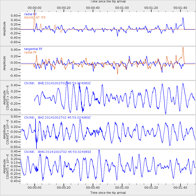
INK INUVIK, NT - Earthquake Result Viewer
*The percent match for this event was below the threshold and hence no stack was calculated.
| Earthquake location: |
Sea Of Okhotsk |
| Earthquake latitude/longitude: |
52.2/151.9 |
| Earthquake time(UTC): |
2014/10/01 (274) 02:41:01 GMT |
| Earthquake Depth: |
558 km |
| Earthquake Magnitude: |
5.3 MW |
| Earthquake Catalog/Contributor: |
ISC/ISC |
|
| Network: |
CN Canadian National Seismograph Network |
| Station: |
INK INUVIK, NT |
| Lat/Lon: |
68.31 N/133.53 W |
| Elevation: |
44 m |
|
| Distance: |
37.6 deg |
| Az: |
35.975 deg |
| Baz: |
283.396 deg |
| Ray Param: |
$rayparam |
*The percent match for this event was below the threshold and hence was not used in the summary stack. |
|
| Radial Match: |
52.78074 % |
| Radial Bump: |
400 |
| Transverse Match: |
60.62369 % |
| Transverse Bump: |
400 |
| SOD ConfigId: |
3390531 |
| Insert Time: |
2019-04-14 07:02:19.145 +0000 |
| GWidth: |
2.5 |
| Max Bumps: |
400 |
| Tol: |
0.001 |
|
Signal To Noise
| Channel | StoN | STA | LTA |
| CN:INK: :BHZ:20141001T02:46:59.024989Z | 1.6790994 | 2.754773E-7 | 1.6406253E-7 |
| CN:INK: :BHN:20141001T02:46:59.024989Z | 0.8684649 | 1.5789797E-7 | 1.8181272E-7 |
| CN:INK: :BHE:20141001T02:46:59.024989Z | 1.414139 | 2.840196E-7 | 2.0084278E-7 |
| Arrivals |
| Ps | |
| PpPs | |
| PsPs/PpSs | |


