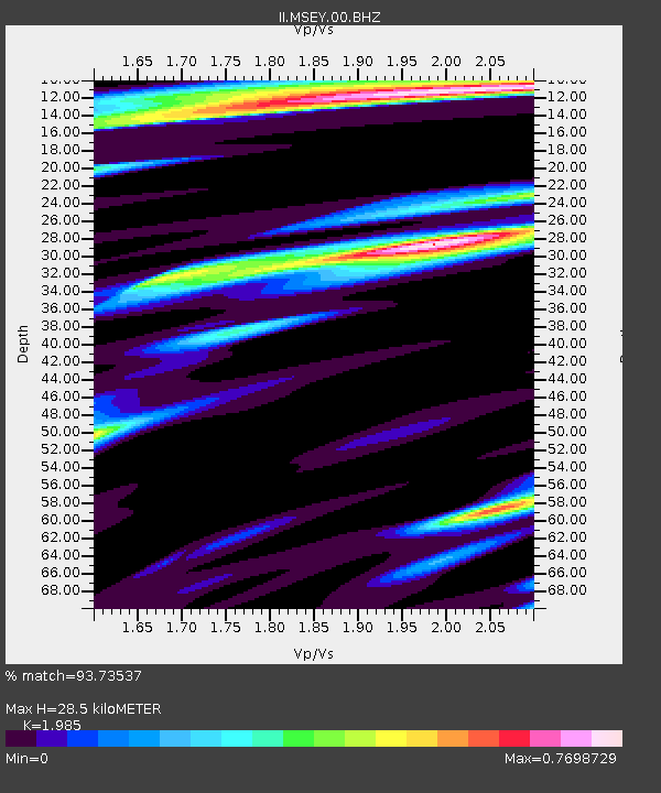
MSEY Mahe, Seychelles - Earthquake Result Viewer
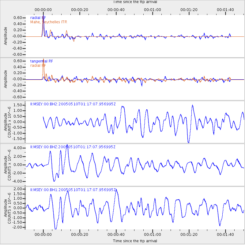
Earthquake location: Southwest Of Sumatra, Indonesia
Earthquake latitude/longitude: -6.2/103.1
Earthquake time(UTC): 2005/05/10 (130) 01:09:05 GMT
Earthquake Depth: 17 km
Earthquake Magnitude: 5.9 MB, 6.4 MS, 6.2 MW, 6.2 MW
Earthquake Catalog/Contributor: WHDF/NEIC
Network: II Global Seismograph Network (GSN - IRIS/IDA)
Station: MSEY Mahe, Seychelles
Lat/Lon: 4.67 S/55.48 E
Elevation: 475 m
Distance: 47.5 deg
Az: 269.367 deg
Baz: 94.139 deg
Ray Param: 0.06995795
Estimated Moho Depth: 28.5 km
Estimated Crust Vp/Vs: 1.99
Assumed Crust Vp: 6.303 km/s
Estimated Crust Vs: 3.175 km/s
Estimated Crust Poisson's Ratio: 0.33
Radial Match: 93.73537 %
Radial Bump: 285
Transverse Match: 75.841034 %
Transverse Bump: 400
SOD ConfigId: 590571
Insert Time: 2013-09-25 12:51:40.199 +0000
GWidth: 2.5
Max Bumps: 400
Tol: 0.001

Signal To Noise

ChannelStoNSTALTA
II:MSEY:00:BHZ:20050510T01:17:07.956995Z4.60901831.3544503E-62.938696E-7
II:MSEY:00:BH1:20050510T01:17:07.956995Z3.69565086.330514E-71.7129632E-7
II:MSEY:00:BH2:20050510T01:17:07.956995Z1.44859453.541984E-72.4451177E-7
Arrivals
Ps4.7 SECOND
PpPs13 SECOND
PsPs/PpSs18 SECOND