You are here: Home > Network List > IU - Global Seismograph Network (GSN - IRIS/USGS) Stations List
> Station RSSD Black Hills, South Dakota, USA > Earthquake Result Viewer
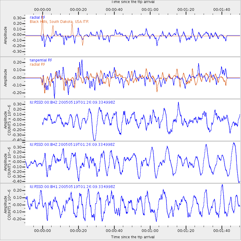
RSSD Black Hills, South Dakota, USA - Earthquake Result Viewer
*The percent match for this event was below the threshold and hence no stack was calculated.
| Earthquake location: |
Near East Coast Of Honshu, Japan |
| Earthquake latitude/longitude: |
35.4/140.8 |
| Earthquake time(UTC): |
2005/05/19 (139) 01:14:28 GMT |
| Earthquake Depth: |
48 km |
| Earthquake Magnitude: |
5.5 MB |
| Earthquake Catalog/Contributor: |
NEIC PDE/NEIC PDE-M |
|
| Network: |
IU Global Seismograph Network (GSN - IRIS/USGS) |
| Station: |
RSSD Black Hills, South Dakota, USA |
| Lat/Lon: |
44.12 N/104.04 W |
| Elevation: |
2060 m |
|
| Distance: |
81.3 deg |
| Az: |
41.263 deg |
| Baz: |
311.598 deg |
| Ray Param: |
$rayparam |
*The percent match for this event was below the threshold and hence was not used in the summary stack. |
|
| Radial Match: |
38.981915 % |
| Radial Bump: |
400 |
| Transverse Match: |
58.414 % |
| Transverse Bump: |
400 |
| SOD ConfigId: |
590571 |
| Insert Time: |
2013-09-25 13:03:49.143 +0000 |
| GWidth: |
2.5 |
| Max Bumps: |
400 |
| Tol: |
0.001 |
|
Signal To Noise
| Channel | StoN | STA | LTA |
| IU:RSSD:00:BHZ:20050519T01:26:09.334998Z | 1.0588986 | 1.2710906E-7 | 1.2003893E-7 |
| IU:RSSD:00:BH1:20050519T01:26:09.334998Z | 1.1190389 | 9.8691096E-8 | 8.819273E-8 |
| IU:RSSD:00:BH2:20050519T01:26:09.334998Z | 2.7509055 | 2.0069066E-7 | 7.29544E-8 |
| Arrivals |
| Ps | |
| PpPs | |
| PsPs/PpSs | |


