You are here: Home > Network List > US - United States National Seismic Network Stations List
> Station MNTX Cornudas Mountains, Texas, USA > Earthquake Result Viewer
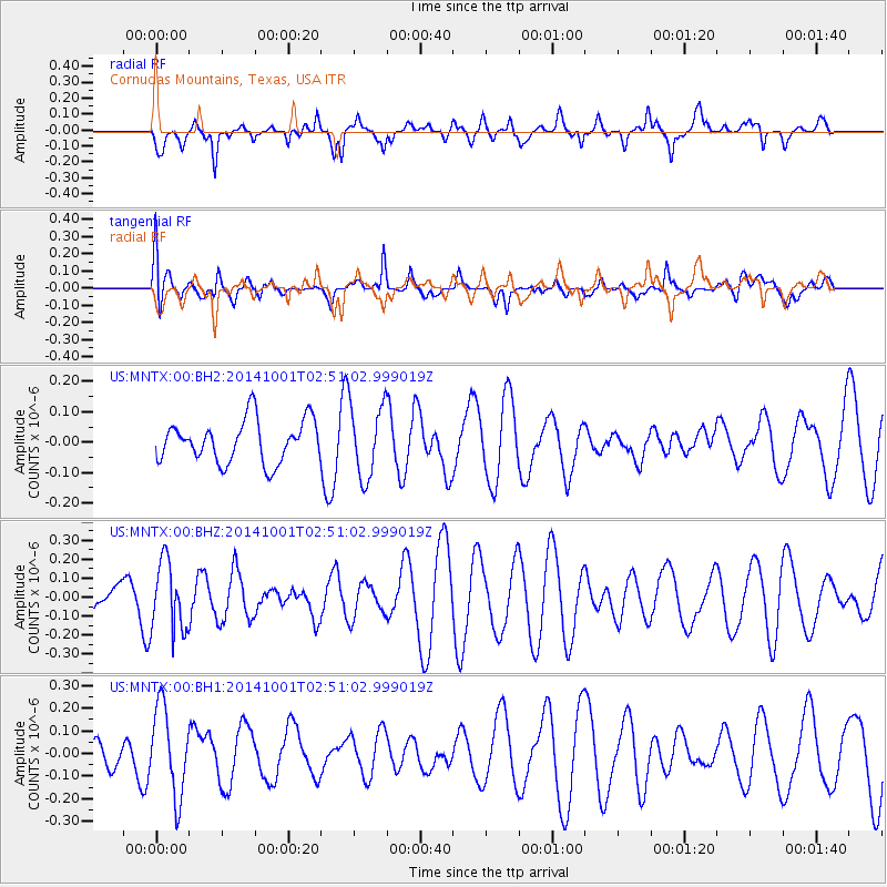
MNTX Cornudas Mountains, Texas, USA - Earthquake Result Viewer
*The percent match for this event was below the threshold and hence no stack was calculated.
| Earthquake location: |
Sea Of Okhotsk |
| Earthquake latitude/longitude: |
52.2/151.9 |
| Earthquake time(UTC): |
2014/10/01 (274) 02:41:01 GMT |
| Earthquake Depth: |
558 km |
| Earthquake Magnitude: |
5.3 MW |
| Earthquake Catalog/Contributor: |
ISC/ISC |
|
| Network: |
US United States National Seismic Network |
| Station: |
MNTX Cornudas Mountains, Texas, USA |
| Lat/Lon: |
31.70 N/105.38 W |
| Elevation: |
404 m |
|
| Distance: |
72.8 deg |
| Az: |
60.501 deg |
| Baz: |
321.048 deg |
| Ray Param: |
$rayparam |
*The percent match for this event was below the threshold and hence was not used in the summary stack. |
|
| Radial Match: |
48.694675 % |
| Radial Bump: |
399 |
| Transverse Match: |
46.3462 % |
| Transverse Bump: |
400 |
| SOD ConfigId: |
3390531 |
| Insert Time: |
2019-04-14 07:07:40.083 +0000 |
| GWidth: |
2.5 |
| Max Bumps: |
400 |
| Tol: |
0.001 |
|
Signal To Noise
| Channel | StoN | STA | LTA |
| US:MNTX:00:BHZ:20141001T02:51:02.999019Z | 1.5071342 | 1.8152662E-7 | 1.204449E-7 |
| US:MNTX:00:BH1:20141001T02:51:02.999019Z | 2.52568 | 1.9470782E-7 | 7.7091244E-8 |
| US:MNTX:00:BH2:20141001T02:51:02.999019Z | 1.7596613 | 1.2157345E-7 | 6.908912E-8 |
| Arrivals |
| Ps | |
| PpPs | |
| PsPs/PpSs | |


