You are here: Home > Network List > IU - Global Seismograph Network (GSN - IRIS/USGS) Stations List
> Station RSSD Black Hills, South Dakota, USA > Earthquake Result Viewer
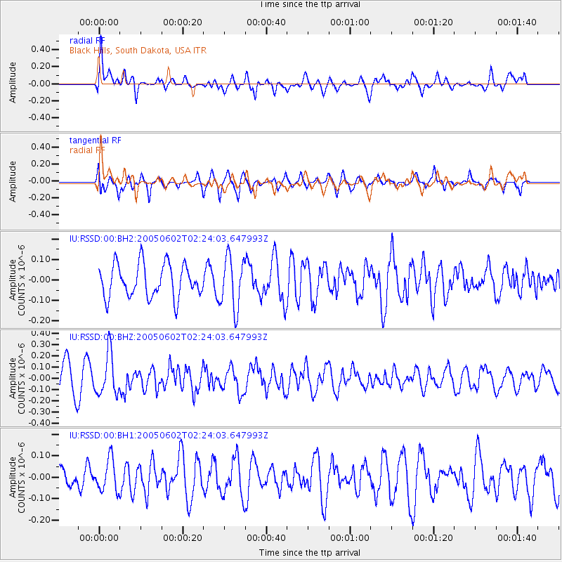
RSSD Black Hills, South Dakota, USA - Earthquake Result Viewer
*The percent match for this event was below the threshold and hence no stack was calculated.
| Earthquake location: |
South Of Fiji Islands |
| Earthquake latitude/longitude: |
-20.2/178.9 |
| Earthquake time(UTC): |
2005/06/02 (153) 02:11:14 GMT |
| Earthquake Depth: |
22 km |
| Earthquake Magnitude: |
5.5 MW, 5.6 MW, 5.8 MB |
| Earthquake Catalog/Contributor: |
NEIC PDE/NEIC PDE-M |
|
| Network: |
IU Global Seismograph Network (GSN - IRIS/USGS) |
| Station: |
RSSD Black Hills, South Dakota, USA |
| Lat/Lon: |
44.12 N/104.04 W |
| Elevation: |
2060 m |
|
| Distance: |
95.0 deg |
| Az: |
44.801 deg |
| Baz: |
246.766 deg |
| Ray Param: |
$rayparam |
*The percent match for this event was below the threshold and hence was not used in the summary stack. |
|
| Radial Match: |
61.73508 % |
| Radial Bump: |
400 |
| Transverse Match: |
58.2798 % |
| Transverse Bump: |
398 |
| SOD ConfigId: |
590571 |
| Insert Time: |
2013-09-25 13:13:50.161 +0000 |
| GWidth: |
2.5 |
| Max Bumps: |
400 |
| Tol: |
0.001 |
|
Signal To Noise
| Channel | StoN | STA | LTA |
| IU:RSSD:00:BHZ:20050602T02:24:03.647993Z | 1.9123803 | 1.888898E-7 | 9.8772084E-8 |
| IU:RSSD:00:BH1:20050602T02:24:03.647993Z | 0.87230045 | 7.65965E-8 | 8.780977E-8 |
| IU:RSSD:00:BH2:20050602T02:24:03.647993Z | 1.5739284 | 1.2662392E-7 | 8.0450874E-8 |
| Arrivals |
| Ps | |
| PpPs | |
| PsPs/PpSs | |


