You are here: Home > Network List > IU - Global Seismograph Network (GSN - IRIS/USGS) Stations List
> Station POHA Pohakuloa, Hawaii, USA > Earthquake Result Viewer
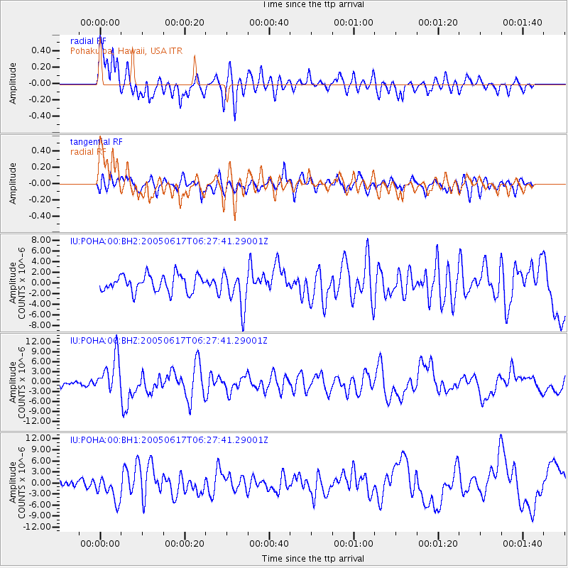
POHA Pohakuloa, Hawaii, USA - Earthquake Result Viewer
*The percent match for this event was below the threshold and hence no stack was calculated.
| Earthquake location: |
Off Coast Of Northern California |
| Earthquake latitude/longitude: |
40.8/-126.6 |
| Earthquake time(UTC): |
2005/06/17 (168) 06:21:42 GMT |
| Earthquake Depth: |
10 km |
| Earthquake Magnitude: |
6.2 MB, 6.5 MS, 6.7 MW, 6.6 MW |
| Earthquake Catalog/Contributor: |
WHDF/NEIC |
|
| Network: |
IU Global Seismograph Network (GSN - IRIS/USGS) |
| Station: |
POHA Pohakuloa, Hawaii, USA |
| Lat/Lon: |
19.76 N/155.53 W |
| Elevation: |
1967 m |
|
| Distance: |
32.4 deg |
| Az: |
238.374 deg |
| Baz: |
43.366 deg |
| Ray Param: |
$rayparam |
*The percent match for this event was below the threshold and hence was not used in the summary stack. |
|
| Radial Match: |
78.7601 % |
| Radial Bump: |
400 |
| Transverse Match: |
63.06213 % |
| Transverse Bump: |
400 |
| SOD ConfigId: |
590571 |
| Insert Time: |
2013-09-25 13:41:56.624 +0000 |
| GWidth: |
2.5 |
| Max Bumps: |
400 |
| Tol: |
0.001 |
|
Signal To Noise
| Channel | StoN | STA | LTA |
| IU:POHA:00:BHZ:20050617T06:27:41.29001Z | 7.0379324 | 5.709603E-6 | 8.1126143E-7 |
| IU:POHA:00:BH1:20050617T06:27:41.29001Z | 3.3400998 | 3.5851895E-6 | 1.0733779E-6 |
| IU:POHA:00:BH2:20050617T06:27:41.29001Z | 2.294232 | 3.5337328E-6 | 1.5402683E-6 |
| Arrivals |
| Ps | |
| PpPs | |
| PsPs/PpSs | |


