You are here: Home > Network List > IU - Global Seismograph Network (GSN - IRIS/USGS) Stations List
> Station POHA Pohakuloa, Hawaii, USA > Earthquake Result Viewer
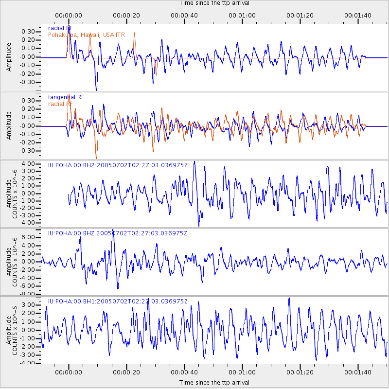
POHA Pohakuloa, Hawaii, USA - Earthquake Result Viewer
*The percent match for this event was below the threshold and hence no stack was calculated.
| Earthquake location: |
Near Coast Of Nicaragua |
| Earthquake latitude/longitude: |
11.2/-86.2 |
| Earthquake time(UTC): |
2005/07/02 (183) 02:16:43 GMT |
| Earthquake Depth: |
27 km |
| Earthquake Magnitude: |
5.6 MB, 6.4 MS, 6.6 MW, 6.6 MW |
| Earthquake Catalog/Contributor: |
WHDF/NEIC |
|
| Network: |
IU Global Seismograph Network (GSN - IRIS/USGS) |
| Station: |
POHA Pohakuloa, Hawaii, USA |
| Lat/Lon: |
19.76 N/155.53 W |
| Elevation: |
1967 m |
|
| Distance: |
67.0 deg |
| Az: |
286.754 deg |
| Baz: |
85.871 deg |
| Ray Param: |
$rayparam |
*The percent match for this event was below the threshold and hence was not used in the summary stack. |
|
| Radial Match: |
72.625435 % |
| Radial Bump: |
400 |
| Transverse Match: |
55.44707 % |
| Transverse Bump: |
400 |
| SOD ConfigId: |
590571 |
| Insert Time: |
2013-09-25 13:58:13.921 +0000 |
| GWidth: |
2.5 |
| Max Bumps: |
400 |
| Tol: |
0.001 |
|
Signal To Noise
| Channel | StoN | STA | LTA |
| IU:POHA:00:BHZ:20050702T02:27:03.036975Z | 4.6738963 | 2.437595E-6 | 5.2153376E-7 |
| IU:POHA:00:BH1:20050702T02:27:03.036975Z | 1.0033711 | 1.0126591E-6 | 1.0092568E-6 |
| IU:POHA:00:BH2:20050702T02:27:03.036975Z | 1.3319895 | 1.2396929E-6 | 9.3070764E-7 |
| Arrivals |
| Ps | |
| PpPs | |
| PsPs/PpSs | |


