You are here: Home > Network List > II - Global Seismograph Network (GSN - IRIS/IDA) Stations List
> Station MBAR Mbarara, Uganda > Earthquake Result Viewer
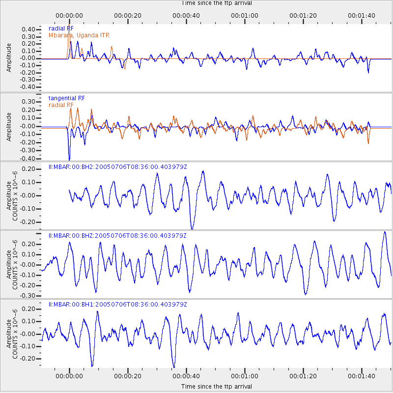
MBAR Mbarara, Uganda - Earthquake Result Viewer
*The percent match for this event was below the threshold and hence no stack was calculated.
| Earthquake location: |
Jan Mayen Island Region |
| Earthquake latitude/longitude: |
69.0/-16.6 |
| Earthquake time(UTC): |
2005/07/06 (187) 08:24:41 GMT |
| Earthquake Depth: |
10 km |
| Earthquake Magnitude: |
5.1 MB, 5.2 MS, 5.6 MW, 5.5 MW |
| Earthquake Catalog/Contributor: |
WHDF/NEIC |
|
| Network: |
II Global Seismograph Network (GSN - IRIS/IDA) |
| Station: |
MBAR Mbarara, Uganda |
| Lat/Lon: |
0.60 S/30.74 E |
| Elevation: |
1390 m |
|
| Distance: |
76.4 deg |
| Az: |
130.814 deg |
| Baz: |
344.17 deg |
| Ray Param: |
$rayparam |
*The percent match for this event was below the threshold and hence was not used in the summary stack. |
|
| Radial Match: |
64.73005 % |
| Radial Bump: |
400 |
| Transverse Match: |
44.15003 % |
| Transverse Bump: |
310 |
| SOD ConfigId: |
590571 |
| Insert Time: |
2013-09-25 14:03:45.605 +0000 |
| GWidth: |
2.5 |
| Max Bumps: |
400 |
| Tol: |
0.001 |
|
Signal To Noise
| Channel | StoN | STA | LTA |
| II:MBAR:00:BHZ:20050706T08:36:00.403979Z | 2.592755 | 1.3778416E-7 | 5.3141985E-8 |
| II:MBAR:00:BH1:20050706T08:36:00.403979Z | 1.4791051 | 6.4527136E-8 | 4.3625793E-8 |
| II:MBAR:00:BH2:20050706T08:36:00.403979Z | 1.8399115 | 8.638656E-8 | 4.6951477E-8 |
| Arrivals |
| Ps | |
| PpPs | |
| PsPs/PpSs | |


