You are here: Home > Network List > II - Global Seismograph Network (GSN - IRIS/IDA) Stations List
> Station MBAR Mbarara, Uganda > Earthquake Result Viewer
MBAR Mbarara, Uganda - Earthquake Result Viewer
*The percent match for this event was below the threshold and hence no stack was calculated.
| Earthquake location: |
Mongolia |
| Earthquake latitude/longitude: |
43.1/109.0 |
| Earthquake time(UTC): |
2005/07/20 (201) 21:54:05 GMT |
| Earthquake Depth: |
6.0 km |
| Earthquake Magnitude: |
5.5 MB, 4.8 MS, 5.3 MW, 5.2 MW |
| Earthquake Catalog/Contributor: |
WHDF/NEIC |
|
| Network: |
II Global Seismograph Network (GSN - IRIS/IDA) |
| Station: |
MBAR Mbarara, Uganda |
| Lat/Lon: |
0.60 S/30.74 E |
| Elevation: |
1390 m |
|
| Distance: |
81.8 deg |
| Az: |
261.527 deg |
| Baz: |
46.46 deg |
| Ray Param: |
$rayparam |
*The percent match for this event was below the threshold and hence was not used in the summary stack. |
|
| Radial Match: |
57.77619 % |
| Radial Bump: |
400 |
| Transverse Match: |
57.423725 % |
| Transverse Bump: |
373 |
| SOD ConfigId: |
590571 |
| Insert Time: |
2013-09-25 14:22:35.298 +0000 |
| GWidth: |
2.5 |
| Max Bumps: |
400 |
| Tol: |
0.001 |
|
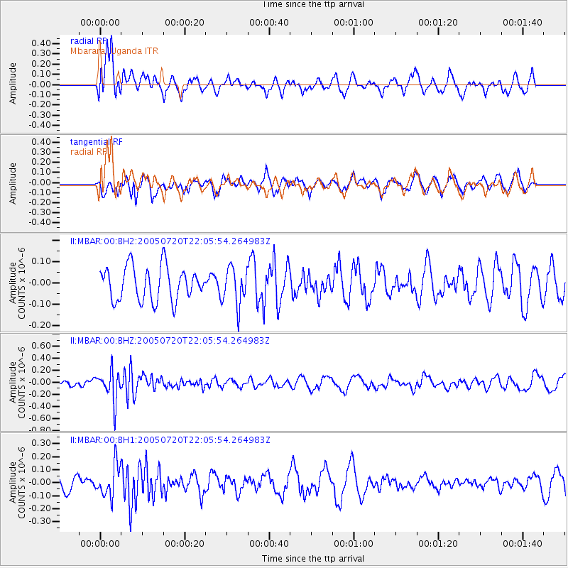
Signal To Noise
| Channel | StoN | STA | LTA |
| II:MBAR:00:BHZ:20050720T22:05:54.264983Z | 5.446383 | 2.5371781E-7 | 4.6584645E-8 |
| II:MBAR:00:BH1:20050720T22:05:54.264983Z | 2.6857214 | 1.2512214E-7 | 4.658791E-8 |
| II:MBAR:00:BH2:20050720T22:05:54.264983Z | 1.1247792 | 8.860464E-8 | 7.877514E-8 |
| Arrivals |
| Ps | |
| PpPs | |
| PsPs/PpSs | |


