You are here: Home > Network List > IU - Global Seismograph Network (GSN - IRIS/USGS) Stations List
> Station RSSD Black Hills, South Dakota, USA > Earthquake Result Viewer
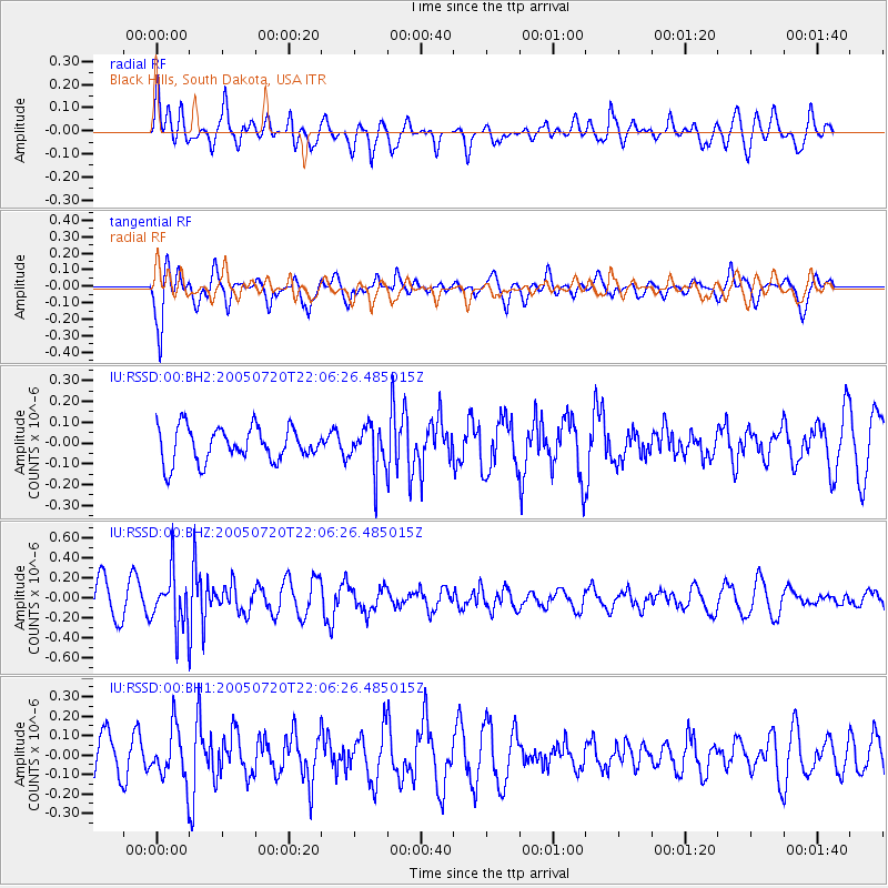
RSSD Black Hills, South Dakota, USA - Earthquake Result Viewer
*The percent match for this event was below the threshold and hence no stack was calculated.
| Earthquake location: |
Mongolia |
| Earthquake latitude/longitude: |
43.1/109.0 |
| Earthquake time(UTC): |
2005/07/20 (201) 21:54:05 GMT |
| Earthquake Depth: |
6.0 km |
| Earthquake Magnitude: |
5.5 MB, 4.8 MS, 5.3 MW, 5.2 MW |
| Earthquake Catalog/Contributor: |
WHDF/NEIC |
|
| Network: |
IU Global Seismograph Network (GSN - IRIS/USGS) |
| Station: |
RSSD Black Hills, South Dakota, USA |
| Lat/Lon: |
44.12 N/104.04 W |
| Elevation: |
2060 m |
|
| Distance: |
88.3 deg |
| Az: |
23.141 deg |
| Baz: |
336.429 deg |
| Ray Param: |
$rayparam |
*The percent match for this event was below the threshold and hence was not used in the summary stack. |
|
| Radial Match: |
73.885086 % |
| Radial Bump: |
400 |
| Transverse Match: |
72.40641 % |
| Transverse Bump: |
400 |
| SOD ConfigId: |
590571 |
| Insert Time: |
2013-09-25 14:22:43.230 +0000 |
| GWidth: |
2.5 |
| Max Bumps: |
400 |
| Tol: |
0.001 |
|
Signal To Noise
| Channel | StoN | STA | LTA |
| IU:RSSD:00:BHZ:20050720T22:06:26.485015Z | 1.4865085 | 2.751587E-7 | 1.8510403E-7 |
| IU:RSSD:00:BH1:20050720T22:06:26.485015Z | 1.0836302 | 1.317051E-7 | 1.2154062E-7 |
| IU:RSSD:00:BH2:20050720T22:06:26.485015Z | 1.2730272 | 1.0378016E-7 | 8.152235E-8 |
| Arrivals |
| Ps | |
| PpPs | |
| PsPs/PpSs | |


