You are here: Home > Network List > IU - Global Seismograph Network (GSN - IRIS/USGS) Stations List
> Station RSSD Black Hills, South Dakota, USA > Earthquake Result Viewer
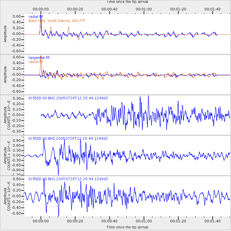
RSSD Black Hills, South Dakota, USA - Earthquake Result Viewer
*The percent match for this event was below the threshold and hence no stack was calculated.
| Earthquake location: |
Off East Coast Of Kamchatka |
| Earthquake latitude/longitude: |
52.9/160.1 |
| Earthquake time(UTC): |
2005/07/26 (207) 12:17:14 GMT |
| Earthquake Depth: |
28 km |
| Earthquake Magnitude: |
5.4 MB, 5.4 MS, 5.8 MW, 5.7 MW |
| Earthquake Catalog/Contributor: |
WHDF/NEIC |
|
| Network: |
IU Global Seismograph Network (GSN - IRIS/USGS) |
| Station: |
RSSD Black Hills, South Dakota, USA |
| Lat/Lon: |
44.12 N/104.04 W |
| Elevation: |
2060 m |
|
| Distance: |
59.5 deg |
| Az: |
56.233 deg |
| Baz: |
315.597 deg |
| Ray Param: |
$rayparam |
*The percent match for this event was below the threshold and hence was not used in the summary stack. |
|
| Radial Match: |
79.13429 % |
| Radial Bump: |
400 |
| Transverse Match: |
71.90311 % |
| Transverse Bump: |
400 |
| SOD ConfigId: |
590571 |
| Insert Time: |
2013-09-25 14:32:52.957 +0000 |
| GWidth: |
2.5 |
| Max Bumps: |
400 |
| Tol: |
0.001 |
|
Signal To Noise
| Channel | StoN | STA | LTA |
| IU:RSSD:00:BHZ:20050726T12:26:44.13499Z | 5.419557 | 4.0983343E-7 | 7.562121E-8 |
| IU:RSSD:00:BH1:20050726T12:26:44.13499Z | 3.2145753 | 2.4465734E-7 | 7.610876E-8 |
| IU:RSSD:00:BH2:20050726T12:26:44.13499Z | 2.2372437 | 6.841455E-8 | 3.0579837E-8 |
| Arrivals |
| Ps | |
| PpPs | |
| PsPs/PpSs | |


