You are here: Home > Network List > IU - Global Seismograph Network (GSN - IRIS/USGS) Stations List
> Station RSSD Black Hills, South Dakota, USA > Earthquake Result Viewer
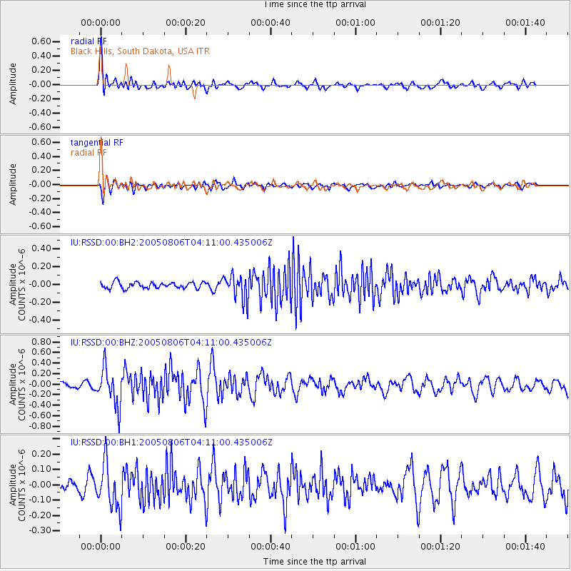
RSSD Black Hills, South Dakota, USA - Earthquake Result Viewer
*The percent match for this event was below the threshold and hence no stack was calculated.
| Earthquake location: |
North Of Severnaya Zemlya |
| Earthquake latitude/longitude: |
85.3/97.2 |
| Earthquake time(UTC): |
2005/08/06 (218) 04:02:32 GMT |
| Earthquake Depth: |
10 km |
| Earthquake Magnitude: |
5.5 MW, 4.9 MS, 5.4 MB, 5.4 MW |
| Earthquake Catalog/Contributor: |
WHDF/NEIC |
|
| Network: |
IU Global Seismograph Network (GSN - IRIS/USGS) |
| Station: |
RSSD Black Hills, South Dakota, USA |
| Lat/Lon: |
44.12 N/104.04 W |
| Elevation: |
2060 m |
|
| Distance: |
50.5 deg |
| Az: |
19.714 deg |
| Baz: |
357.768 deg |
| Ray Param: |
$rayparam |
*The percent match for this event was below the threshold and hence was not used in the summary stack. |
|
| Radial Match: |
76.21297 % |
| Radial Bump: |
400 |
| Transverse Match: |
60.304108 % |
| Transverse Bump: |
400 |
| SOD ConfigId: |
590571 |
| Insert Time: |
2013-09-25 14:47:59.689 +0000 |
| GWidth: |
2.5 |
| Max Bumps: |
400 |
| Tol: |
0.001 |
|
Signal To Noise
| Channel | StoN | STA | LTA |
| IU:RSSD:00:BHZ:20050806T04:11:00.435006Z | 5.5188456 | 3.6560294E-7 | 6.624627E-8 |
| IU:RSSD:00:BH1:20050806T04:11:00.435006Z | 2.580394 | 1.5090109E-7 | 5.8479863E-8 |
| IU:RSSD:00:BH2:20050806T04:11:00.435006Z | 4.1641927 | 1.4150967E-7 | 3.39825E-8 |
| Arrivals |
| Ps | |
| PpPs | |
| PsPs/PpSs | |


