
PALK Pallekele, Sri Lanka - Earthquake Result Viewer
| ||||||||||||||||||
| ||||||||||||||||||
| ||||||||||||||||||
|
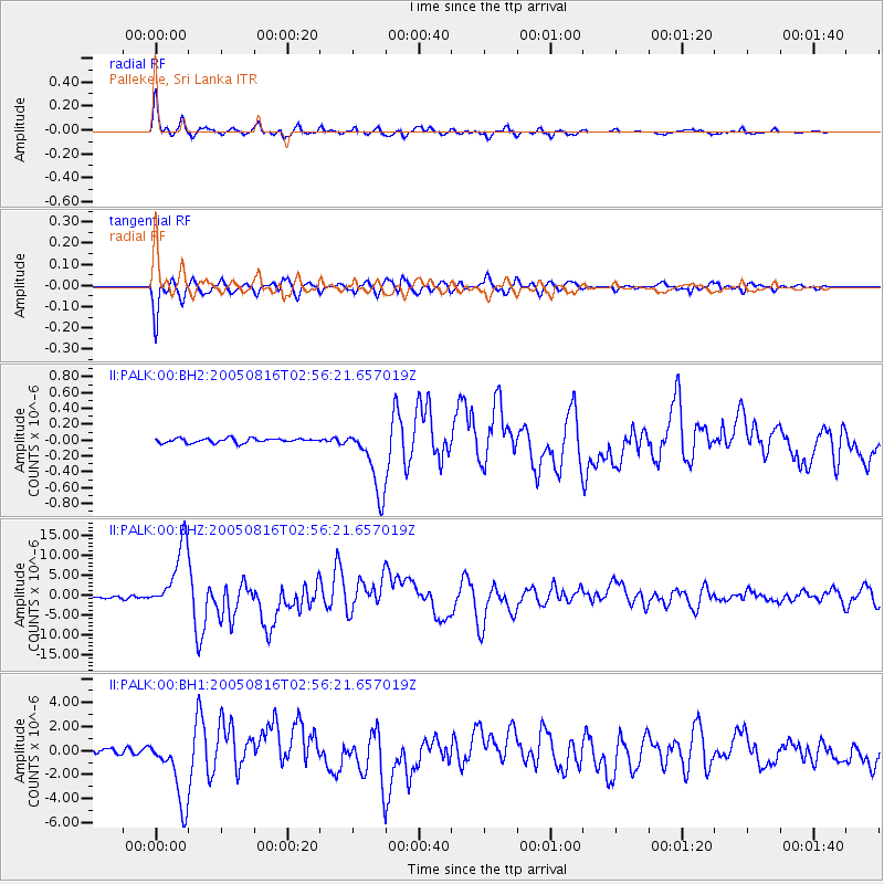
Signal To Noise
| Channel | StoN | STA | LTA |
| II:PALK:00:BHZ:20050816T02:56:21.657019Z | 25.417257 | 8.414828E-6 | 3.3106747E-7 |
| II:PALK:00:BH1:20050816T02:56:21.657019Z | 14.143374 | 2.835645E-6 | 2.0049282E-7 |
| II:PALK:00:BH2:20050816T02:56:21.657019Z | 15.374898 | 4.3070537E-7 | 2.8013542E-8 |
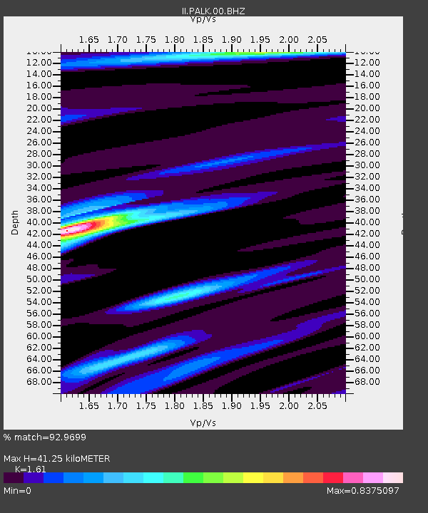
| Arrivals | |
| Ps | 4.0 SECOND |
| PpPs | 16 SECOND |
| PsPs/PpSs | 20 SECOND |

