You are here: Home > Network List > TA - USArray Transportable Network (new EarthScope stations) Stations List
> Station O03E Paynes Creek, CA, USA > Earthquake Result Viewer
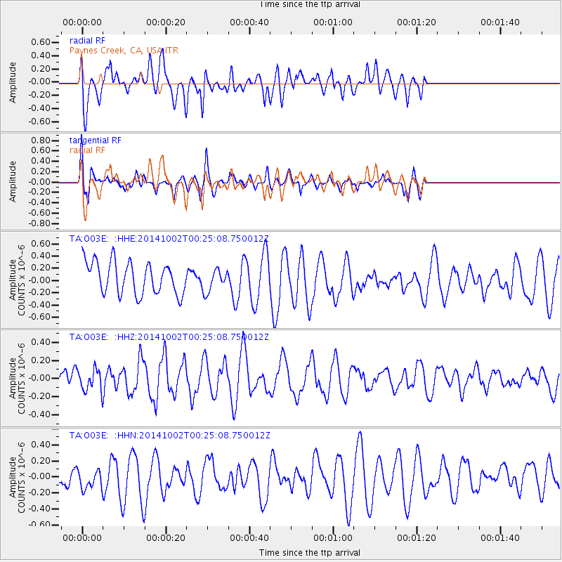
O03E Paynes Creek, CA, USA - Earthquake Result Viewer
*The percent match for this event was below the threshold and hence no stack was calculated.
| Earthquake location: |
Tonga Islands |
| Earthquake latitude/longitude: |
-21.1/-174.5 |
| Earthquake time(UTC): |
2014/10/02 (275) 00:13:39 GMT |
| Earthquake Depth: |
10 km |
| Earthquake Magnitude: |
5.1 MW |
| Earthquake Catalog/Contributor: |
ISC/ISC |
|
| Network: |
TA USArray Transportable Network (new EarthScope stations) |
| Station: |
O03E Paynes Creek, CA, USA |
| Lat/Lon: |
40.29 N/121.80 W |
| Elevation: |
967 m |
|
| Distance: |
78.3 deg |
| Az: |
38.378 deg |
| Baz: |
229.263 deg |
| Ray Param: |
$rayparam |
*The percent match for this event was below the threshold and hence was not used in the summary stack. |
|
| Radial Match: |
55.461708 % |
| Radial Bump: |
400 |
| Transverse Match: |
58.492958 % |
| Transverse Bump: |
400 |
| SOD ConfigId: |
3390531 |
| Insert Time: |
2019-04-14 07:21:35.442 +0000 |
| GWidth: |
2.5 |
| Max Bumps: |
400 |
| Tol: |
0.001 |
|
Signal To Noise
| Channel | StoN | STA | LTA |
| TA:O03E: :HHZ:20141002T00:25:08.750012Z | 0.98454726 | 1.1236256E-7 | 1.1412612E-7 |
| TA:O03E: :HHN:20141002T00:25:08.750012Z | 0.8602798 | 1.3794178E-7 | 1.6034527E-7 |
| TA:O03E: :HHE:20141002T00:25:08.750012Z | 0.69932705 | 1.829497E-7 | 2.6160822E-7 |
| Arrivals |
| Ps | |
| PpPs | |
| PsPs/PpSs | |


