You are here: Home > Network List > II - Global Seismograph Network (GSN - IRIS/IDA) Stations List
> Station MBAR Mbarara, Uganda > Earthquake Result Viewer
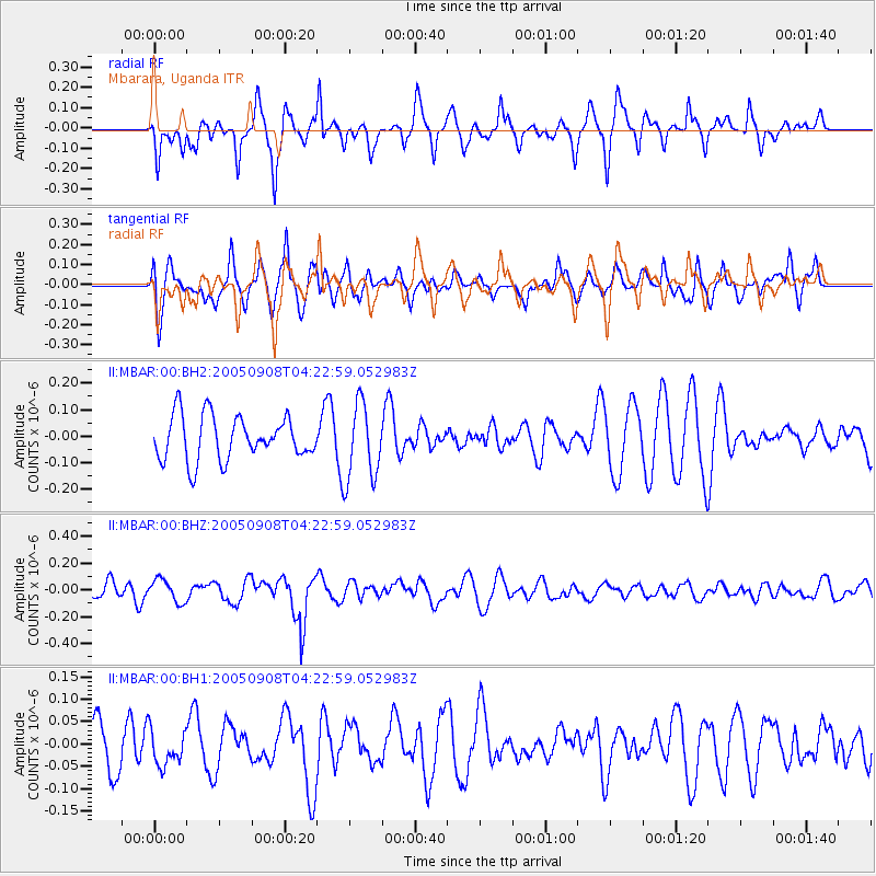
MBAR Mbarara, Uganda - Earthquake Result Viewer
*The percent match for this event was below the threshold and hence no stack was calculated.
| Earthquake location: |
Northern Molucca Sea |
| Earthquake latitude/longitude: |
0.8/126.3 |
| Earthquake time(UTC): |
2005/09/08 (251) 04:10:10 GMT |
| Earthquake Depth: |
49 km |
| Earthquake Magnitude: |
5.6 MB, 5.2 MS, 5.7 MW, 5.6 MW |
| Earthquake Catalog/Contributor: |
WHDF/NEIC |
|
| Network: |
II Global Seismograph Network (GSN - IRIS/IDA) |
| Station: |
MBAR Mbarara, Uganda |
| Lat/Lon: |
0.60 S/30.74 E |
| Elevation: |
1390 m |
|
| Distance: |
95.6 deg |
| Az: |
269.474 deg |
| Baz: |
89.29 deg |
| Ray Param: |
$rayparam |
*The percent match for this event was below the threshold and hence was not used in the summary stack. |
|
| Radial Match: |
62.78245 % |
| Radial Bump: |
377 |
| Transverse Match: |
54.226868 % |
| Transverse Bump: |
400 |
| SOD ConfigId: |
590571 |
| Insert Time: |
2013-09-25 15:33:03.765 +0000 |
| GWidth: |
2.5 |
| Max Bumps: |
400 |
| Tol: |
0.001 |
|
Signal To Noise
| Channel | StoN | STA | LTA |
| II:MBAR:00:BHZ:20050908T04:22:59.052983Z | 1.134586 | 8.466257E-8 | 7.4619784E-8 |
| II:MBAR:00:BH1:20050908T04:22:59.052983Z | 0.591411 | 3.918248E-8 | 6.625254E-8 |
| II:MBAR:00:BH2:20050908T04:22:59.052983Z | 1.7521539 | 1.4497832E-7 | 8.2742915E-8 |
| Arrivals |
| Ps | |
| PpPs | |
| PsPs/PpSs | |


