You are here: Home > Network List > IU - Global Seismograph Network (GSN - IRIS/USGS) Stations List
> Station RSSD Black Hills, South Dakota, USA > Earthquake Result Viewer
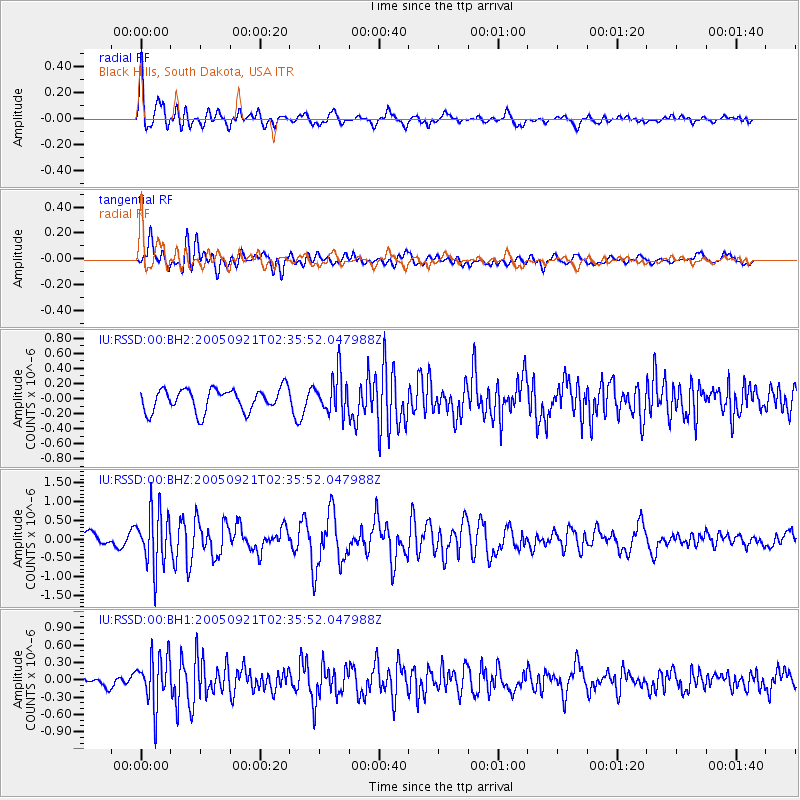
RSSD Black Hills, South Dakota, USA - Earthquake Result Viewer
*The percent match for this event was below the threshold and hence no stack was calculated.
| Earthquake location: |
Kuril Islands |
| Earthquake latitude/longitude: |
43.9/146.1 |
| Earthquake time(UTC): |
2005/09/21 (264) 02:25:08 GMT |
| Earthquake Depth: |
103 km |
| Earthquake Magnitude: |
6.0 MB, 6.1 MW, 6.0 MW |
| Earthquake Catalog/Contributor: |
WHDF/NEIC |
|
| Network: |
IU Global Seismograph Network (GSN - IRIS/USGS) |
| Station: |
RSSD Black Hills, South Dakota, USA |
| Lat/Lon: |
44.12 N/104.04 W |
| Elevation: |
2060 m |
|
| Distance: |
72.4 deg |
| Az: |
45.31 deg |
| Baz: |
314.468 deg |
| Ray Param: |
$rayparam |
*The percent match for this event was below the threshold and hence was not used in the summary stack. |
|
| Radial Match: |
68.18212 % |
| Radial Bump: |
400 |
| Transverse Match: |
68.51481 % |
| Transverse Bump: |
400 |
| SOD ConfigId: |
590571 |
| Insert Time: |
2013-09-25 15:46:11.508 +0000 |
| GWidth: |
2.5 |
| Max Bumps: |
400 |
| Tol: |
0.001 |
|
Signal To Noise
| Channel | StoN | STA | LTA |
| IU:RSSD:00:BHZ:20050921T02:35:52.047988Z | 5.514871 | 7.548765E-7 | 1.3688017E-7 |
| IU:RSSD:00:BH1:20050921T02:35:52.047988Z | 3.48337 | 4.3511866E-7 | 1.2491314E-7 |
| IU:RSSD:00:BH2:20050921T02:35:52.047988Z | 1.7259458 | 2.576017E-7 | 1.4925247E-7 |
| Arrivals |
| Ps | |
| PpPs | |
| PsPs/PpSs | |


