You are here: Home > Network List > IU - Global Seismograph Network (GSN - IRIS/USGS) Stations List
> Station RSSD Black Hills, South Dakota, USA > Earthquake Result Viewer
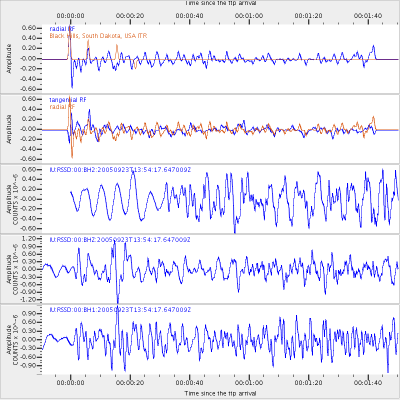
RSSD Black Hills, South Dakota, USA - Earthquake Result Viewer
*The percent match for this event was below the threshold and hence no stack was calculated.
| Earthquake location: |
Caribbean Sea |
| Earthquake latitude/longitude: |
16.1/-87.5 |
| Earthquake time(UTC): |
2005/09/23 (266) 13:48:31 GMT |
| Earthquake Depth: |
30 km |
| Earthquake Magnitude: |
5.9 MB, 5.4 MS, 5.9 MW, 5.9 MW |
| Earthquake Catalog/Contributor: |
WHDF/NEIC |
|
| Network: |
IU Global Seismograph Network (GSN - IRIS/USGS) |
| Station: |
RSSD Black Hills, South Dakota, USA |
| Lat/Lon: |
44.12 N/104.04 W |
| Elevation: |
2060 m |
|
| Distance: |
31.2 deg |
| Az: |
336.693 deg |
| Baz: |
148.13 deg |
| Ray Param: |
$rayparam |
*The percent match for this event was below the threshold and hence was not used in the summary stack. |
|
| Radial Match: |
73.87103 % |
| Radial Bump: |
400 |
| Transverse Match: |
69.823616 % |
| Transverse Bump: |
400 |
| SOD ConfigId: |
590571 |
| Insert Time: |
2013-09-25 15:48:22.508 +0000 |
| GWidth: |
2.5 |
| Max Bumps: |
400 |
| Tol: |
0.001 |
|
Signal To Noise
| Channel | StoN | STA | LTA |
| IU:RSSD:00:BHZ:20050923T13:54:17.647009Z | 1.5356711 | 3.4403698E-7 | 2.2403037E-7 |
| IU:RSSD:00:BH1:20050923T13:54:17.647009Z | 1.8700597 | 3.0934123E-7 | 1.6541783E-7 |
| IU:RSSD:00:BH2:20050923T13:54:17.647009Z | 0.69372135 | 1.7856907E-7 | 2.5740746E-7 |
| Arrivals |
| Ps | |
| PpPs | |
| PsPs/PpSs | |


