You are here: Home > Network List > II - Global Seismograph Network (GSN - IRIS/IDA) Stations List
> Station EFI Mount Kent, East Falkland Island > Earthquake Result Viewer
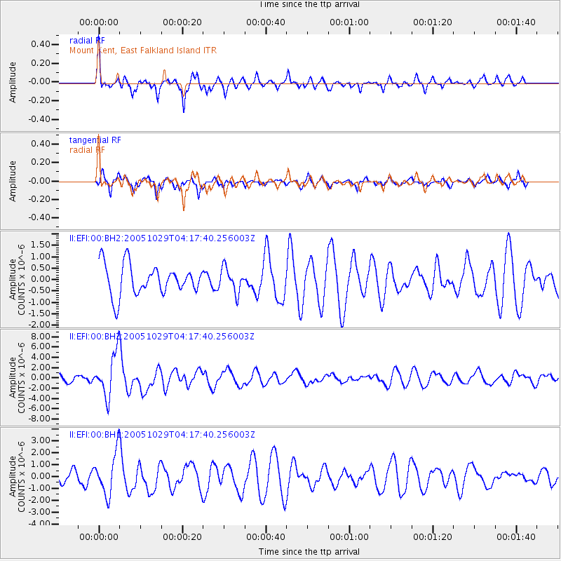
EFI Mount Kent, East Falkland Island - Earthquake Result Viewer

| Earthquake location: |
Southeast Indian Ridge |
| Earthquake latitude/longitude: |
-45.2/96.9 |
| Earthquake time(UTC): |
2005/10/29 (302) 04:05:56 GMT |
| Earthquake Depth: |
8.0 km |
| Earthquake Magnitude: |
6.1 MB, 6.2 MS, 6.5 MW, 6.4 MW |
| Earthquake Catalog/Contributor: |
WHDF/NEIC |
|
| Network: |
II Global Seismograph Network (GSN - IRIS/IDA) |
| Station: |
EFI Mount Kent, East Falkland Island |
| Lat/Lon: |
51.68 S/58.06 W |
| Elevation: |
110 m |
|
| Distance: |
81.1 deg |
| Az: |
195.471 deg |
| Baz: |
162.374 deg |
| Ray Param: |
0.047828607 |
| Estimated Moho Depth: |
39.75 km |
| Estimated Crust Vp/Vs: |
1.69 |
| Assumed Crust Vp: |
6.472 km/s |
| Estimated Crust Vs: |
3.83 km/s |
| Estimated Crust Poisson's Ratio: |
0.23 |
|
| Radial Match: |
81.159966 % |
| Radial Bump: |
400 |
| Transverse Match: |
73.73168 % |
| Transverse Bump: |
386 |
| SOD ConfigId: |
590571 |
| Insert Time: |
2013-09-25 16:46:29.355 +0000 |
| GWidth: |
2.5 |
| Max Bumps: |
400 |
| Tol: |
0.001 |
|
Signal To Noise
| Channel | StoN | STA | LTA |
| II:EFI:00:BHZ:20051029T04:17:40.256003Z | 6.420512 | 4.3499554E-6 | 6.775091E-7 |
| II:EFI:00:BH1:20051029T04:17:40.256003Z | 4.8609533 | 1.8299413E-6 | 3.764573E-7 |
| II:EFI:00:BH2:20051029T04:17:40.256003Z | 0.81642574 | 5.407759E-7 | 6.6237E-7 |
| Arrivals |
| Ps | 4.4 SECOND |
| PpPs | 16 SECOND |
| PsPs/PpSs | 20 SECOND |


