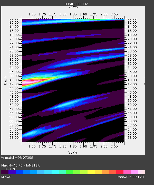
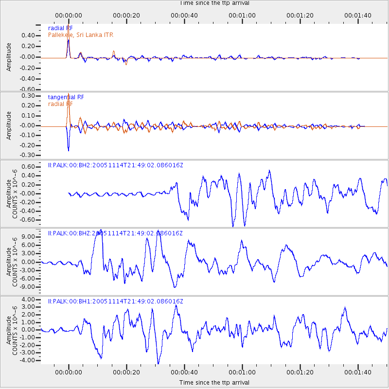
PALK Pallekele, Sri Lanka - Earthquake Result Viewer

Earthquake location: Off East Coast Of Honshu, Japan
Earthquake latitude/longitude: 38.1/144.9
Earthquake time(UTC): 2005/11/14 (318) 21:38:51 GMT
Earthquake Depth: 11 km
Earthquake Magnitude: 6.7 MB, 6.8 MS, 7.0 MW, 6.9 MW
Earthquake Catalog/Contributor: WHDF/NEIC
Network: II Global Seismograph Network (GSN - IRIS/IDA)
Station: PALK Pallekele, Sri Lanka
Lat/Lon: 7.27 N/80.70 E
Elevation: 460 m
Distance: 65.3 deg
Az: 259.458 deg
Baz: 51.422 deg
Ray Param: 0.05836494
Estimated Moho Depth: 40.75 km
Estimated Crust Vp/Vs: 1.60
Assumed Crust Vp: 6.545 km/s
Estimated Crust Vs: 4.091 km/s
Estimated Crust Poisson's Ratio: 0.18
Radial Match: 95.07308 %
Radial Bump: 400
Transverse Match: 93.54978 %
Transverse Bump: 400
SOD ConfigId: 590571
Insert Time: 2013-09-25 17:05:34.847 +0000
GWidth: 2.5
Max Bumps: 400
Tol: 0.001

Signal To Noise

ChannelStoNSTALTA
II:PALK:00:BHZ:20051114T21:49:02.086016Z2.3180836.152113E-72.6539658E-7
II:PALK:00:BH1:20051114T21:49:02.086016Z2.07661962.9638187E-71.4272324E-7
II:PALK:00:BH2:20051114T21:49:02.086016Z1.27115053.347348E-82.6333216E-8
Arrivals
Ps3.9 SECOND
PpPs15 SECOND
PsPs/PpSs19 SECOND