MSEY Mahe, Seychelles - Earthquake Result Viewer
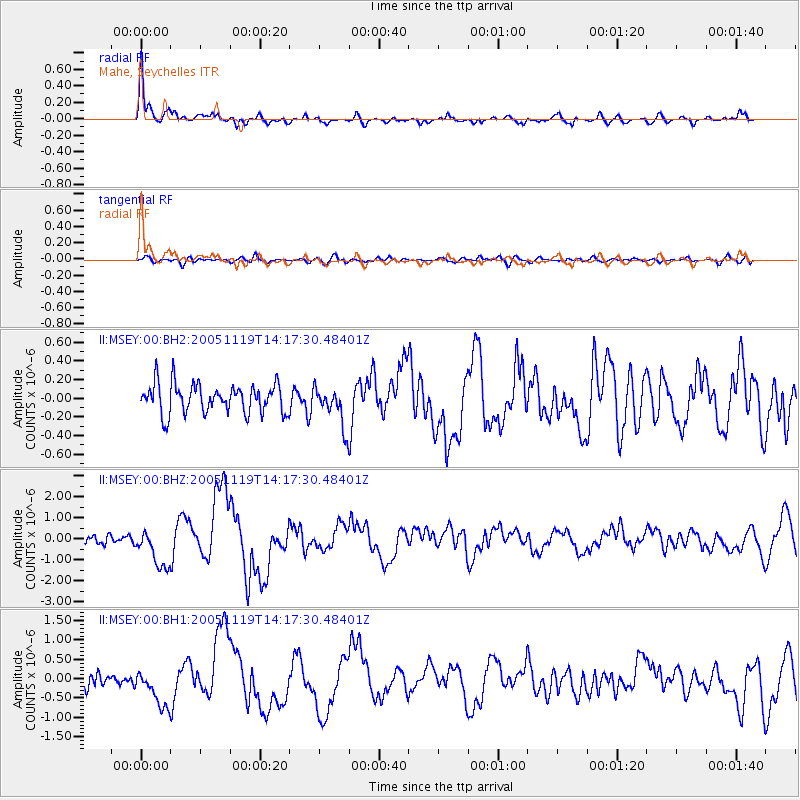
Earthquake location: Northern Sumatra, Indonesia
Earthquake latitude/longitude: 2.2/96.8
Earthquake time(UTC): 2005/11/19 (323) 14:10:13 GMT
Earthquake Depth: 21 km
Earthquake Magnitude: 6.0 MB, 6.1 MS, 6.5 MW, 6.5 MW
Earthquake Catalog/Contributor: WHDF/NEIC
Network: II Global Seismograph Network (GSN - IRIS/IDA)
Station: MSEY Mahe, Seychelles
Lat/Lon: 4.67 S/55.48 E
Elevation: 475 m
Distance: 41.8 deg
Az: 260.596 deg
Baz: 81.537 deg
Ray Param: 0.073514596
Estimated Moho Depth: 27.25 km
Estimated Crust Vp/Vs: 1.93
Assumed Crust Vp: 6.303 km/s
Estimated Crust Vs: 3.257 km/s
Estimated Crust Poisson's Ratio: 0.32
Radial Match: 90.947685 %
Radial Bump: 400
Transverse Match: 62.30379 %
Transverse Bump: 400
SOD ConfigId: 590571
Insert Time: 2013-09-25 17:12:52.623 +0000
GWidth: 2.5
Max Bumps: 400
Tol: 0.001

Signal To Noise

ChannelStoNSTALTA
II:MSEY:00:BHZ:20051119T14:17:30.48401Z5.0188489.326594E-71.8583138E-7
II:MSEY:00:BH1:20051119T14:17:30.48401Z3.2292024.8533866E-71.5029678E-7
II:MSEY:00:BH2:20051119T14:17:30.48401Z1.35602832.1097443E-71.5558261E-7
Arrivals
Ps4.3 SECOND
PpPs12 SECOND
PsPs/PpSs16 SECOND