You are here: Home > Network List > IU - Global Seismograph Network (GSN - IRIS/USGS) Stations List
> Station RSSD Black Hills, South Dakota, USA > Earthquake Result Viewer
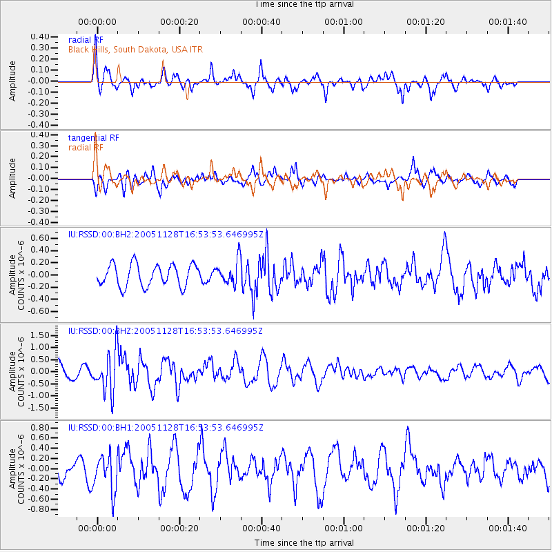
RSSD Black Hills, South Dakota, USA - Earthquake Result Viewer
*The percent match for this event was below the threshold and hence no stack was calculated.
| Earthquake location: |
Mariana Islands Region |
| Earthquake latitude/longitude: |
20.3/146.0 |
| Earthquake time(UTC): |
2005/11/28 (332) 16:41:32 GMT |
| Earthquake Depth: |
41 km |
| Earthquake Magnitude: |
6.1 MB, 5.9 MS, 6.0 MW, 5.9 MW |
| Earthquake Catalog/Contributor: |
WHDF/NEIC |
|
| Network: |
IU Global Seismograph Network (GSN - IRIS/USGS) |
| Station: |
RSSD Black Hills, South Dakota, USA |
| Lat/Lon: |
44.12 N/104.04 W |
| Elevation: |
2060 m |
|
| Distance: |
89.5 deg |
| Az: |
42.619 deg |
| Baz: |
298.049 deg |
| Ray Param: |
$rayparam |
*The percent match for this event was below the threshold and hence was not used in the summary stack. |
|
| Radial Match: |
60.982853 % |
| Radial Bump: |
320 |
| Transverse Match: |
73.188614 % |
| Transverse Bump: |
400 |
| SOD ConfigId: |
590571 |
| Insert Time: |
2013-09-25 17:31:17.293 +0000 |
| GWidth: |
2.5 |
| Max Bumps: |
400 |
| Tol: |
0.001 |
|
Signal To Noise
| Channel | StoN | STA | LTA |
| IU:RSSD:00:BHZ:20051128T16:53:53.646995Z | 2.2916813 | 8.705056E-7 | 3.7985455E-7 |
| IU:RSSD:00:BH1:20051128T16:53:53.646995Z | 1.6200117 | 3.5622782E-7 | 2.1989212E-7 |
| IU:RSSD:00:BH2:20051128T16:53:53.646995Z | 1.1569978 | 2.0857343E-7 | 1.8027124E-7 |
| Arrivals |
| Ps | |
| PpPs | |
| PsPs/PpSs | |


