PALK Pallekele, Sri Lanka - Earthquake Result Viewer
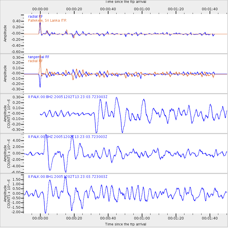
Earthquake location: Near East Coast Of Honshu, Japan
Earthquake latitude/longitude: 38.1/142.1
Earthquake time(UTC): 2005/12/02 (336) 13:13:09 GMT
Earthquake Depth: 29 km
Earthquake Magnitude: 6.1 MB, 6.3 MS, 6.5 MW, 6.4 MW
Earthquake Catalog/Contributor: WHDF/NEIC
Network: II Global Seismograph Network (GSN - IRIS/IDA)
Station: PALK Pallekele, Sri Lanka
Lat/Lon: 7.27 N/80.70 E
Elevation: 460 m
Distance: 63.1 deg
Az: 257.551 deg
Baz: 50.957 deg
Ray Param: 0.059722945
Estimated Moho Depth: 40.0 km
Estimated Crust Vp/Vs: 1.64
Assumed Crust Vp: 6.545 km/s
Estimated Crust Vs: 3.991 km/s
Estimated Crust Poisson's Ratio: 0.20
Radial Match: 91.166985 %
Radial Bump: 389
Transverse Match: 88.40081 %
Transverse Bump: 384
SOD ConfigId: 590571
Insert Time: 2013-09-25 17:37:43.531 +0000
GWidth: 2.5
Max Bumps: 400
Tol: 0.001

Signal To Noise

ChannelStoNSTALTA
II:PALK:00:BHZ:20051202T13:23:03.723003Z13.0744232.8998822E-62.217981E-7
II:PALK:00:BH1:20051202T13:23:03.723003Z5.4721879.577824E-71.7502735E-7
II:PALK:00:BH2:20051202T13:23:03.723003Z5.74744651.6485609E-72.8683363E-8
Arrivals
Ps4.1 SECOND
PpPs15 SECOND
PsPs/PpSs19 SECOND