You are here: Home > Network List > KN - Kyrgyz Seismic Telemetry Network Stations List
> Station TKM2 - > Earthquake Result Viewer
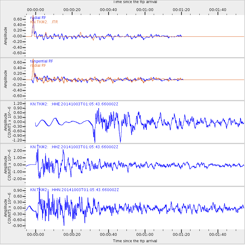
TKM2 - - Earthquake Result Viewer
*The percent match for this event was below the threshold and hence no stack was calculated.
| Earthquake location: |
Near East Coast Of Honshu, Japan |
| Earthquake latitude/longitude: |
40.2/142.8 |
| Earthquake time(UTC): |
2014/10/03 (276) 00:57:30 GMT |
| Earthquake Depth: |
30 km |
| Earthquake Magnitude: |
5.5 MWW, 5.5 MWB, 5.6 MWC |
| Earthquake Catalog/Contributor: |
NEIC PDE/NEIC COMCAT |
|
| Network: |
KN Kyrgyz Seismic Telemetry Network |
| Station: |
TKM2 - |
| Lat/Lon: |
42.92 N/75.60 E |
| Elevation: |
2020 m |
|
| Distance: |
49.1 deg |
| Az: |
296.459 deg |
| Baz: |
69.073 deg |
| Ray Param: |
$rayparam |
*The percent match for this event was below the threshold and hence was not used in the summary stack. |
|
| Radial Match: |
75.88201 % |
| Radial Bump: |
400 |
| Transverse Match: |
80.66233 % |
| Transverse Bump: |
400 |
| SOD ConfigId: |
3390531 |
| Insert Time: |
2019-04-14 07:56:42.767 +0000 |
| GWidth: |
2.5 |
| Max Bumps: |
400 |
| Tol: |
0.001 |
|
Signal To Noise
| Channel | StoN | STA | LTA |
| KN:TKM2: :HHZ:20141003T01:05:43.660002Z | 8.195854 | 1.0535921E-6 | 1.2855183E-7 |
| KN:TKM2: :HHN:20141003T01:05:43.660002Z | 8.105787 | 3.4506616E-7 | 4.2570345E-8 |
| KN:TKM2: :HHE:20141003T01:05:43.660002Z | 4.2533336 | 5.08096E-7 | 1.194583E-7 |
| Arrivals |
| Ps | |
| PpPs | |
| PsPs/PpSs | |


