You are here: Home > Network List > IU - Global Seismograph Network (GSN - IRIS/USGS) Stations List
> Station RSSD Black Hills, South Dakota, USA > Earthquake Result Viewer
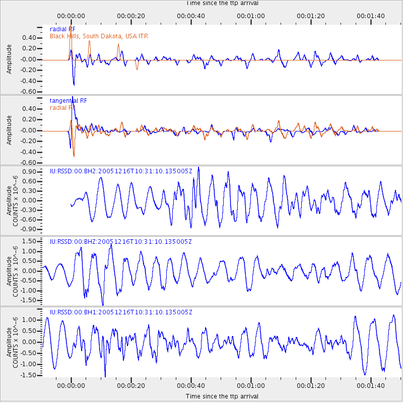
RSSD Black Hills, South Dakota, USA - Earthquake Result Viewer
*The percent match for this event was below the threshold and hence no stack was calculated.
| Earthquake location: |
Off Coast Of Central America |
| Earthquake latitude/longitude: |
12.3/-89.5 |
| Earthquake time(UTC): |
2005/12/16 (350) 10:24:58 GMT |
| Earthquake Depth: |
35 km |
| Earthquake Magnitude: |
5.5 MB, 5.0 MS, 5.7 MW, 5.6 MW |
| Earthquake Catalog/Contributor: |
WHDF/NEIC |
|
| Network: |
IU Global Seismograph Network (GSN - IRIS/USGS) |
| Station: |
RSSD Black Hills, South Dakota, USA |
| Lat/Lon: |
44.12 N/104.04 W |
| Elevation: |
2060 m |
|
| Distance: |
34.1 deg |
| Az: |
341.23 deg |
| Baz: |
154.104 deg |
| Ray Param: |
$rayparam |
*The percent match for this event was below the threshold and hence was not used in the summary stack. |
|
| Radial Match: |
53.77814 % |
| Radial Bump: |
400 |
| Transverse Match: |
81.75204 % |
| Transverse Bump: |
400 |
| SOD ConfigId: |
590571 |
| Insert Time: |
2013-09-25 18:05:18.117 +0000 |
| GWidth: |
2.5 |
| Max Bumps: |
400 |
| Tol: |
0.001 |
|
Signal To Noise
| Channel | StoN | STA | LTA |
| IU:RSSD:00:BHZ:20051216T10:31:10.135005Z | 2.192495 | 8.220619E-7 | 3.7494354E-7 |
| IU:RSSD:00:BH1:20051216T10:31:10.135005Z | 0.8811553 | 4.2938123E-7 | 4.872935E-7 |
| IU:RSSD:00:BH2:20051216T10:31:10.135005Z | 0.85819596 | 3.0007882E-7 | 3.4966237E-7 |
| Arrivals |
| Ps | |
| PpPs | |
| PsPs/PpSs | |


