You are here: Home > Network List > IU - Global Seismograph Network (GSN - IRIS/USGS) Stations List
> Station POHA Pohakuloa, Hawaii, USA > Earthquake Result Viewer
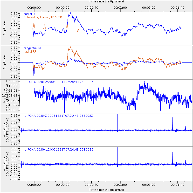
POHA Pohakuloa, Hawaii, USA - Earthquake Result Viewer
*The percent match for this event was below the threshold and hence no stack was calculated.
| Earthquake location: |
Southern Molucca Sea |
| Earthquake latitude/longitude: |
-0.1/124.7 |
| Earthquake time(UTC): |
2005/12/21 (355) 07:09:05 GMT |
| Earthquake Depth: |
25 km |
| Earthquake Magnitude: |
6.3 MB, 5.9 MS, 6.3 MW, 6.2 MW |
| Earthquake Catalog/Contributor: |
WHDF/NEIC |
|
| Network: |
IU Global Seismograph Network (GSN - IRIS/USGS) |
| Station: |
POHA Pohakuloa, Hawaii, USA |
| Lat/Lon: |
19.76 N/155.53 W |
| Elevation: |
1967 m |
|
| Distance: |
80.4 deg |
| Az: |
70.063 deg |
| Baz: |
266.476 deg |
| Ray Param: |
$rayparam |
*The percent match for this event was below the threshold and hence was not used in the summary stack. |
|
| Radial Match: |
62.4663 % |
| Radial Bump: |
400 |
| Transverse Match: |
74.33044 % |
| Transverse Bump: |
400 |
| SOD ConfigId: |
590571 |
| Insert Time: |
2013-09-25 18:11:29.907 +0000 |
| GWidth: |
2.5 |
| Max Bumps: |
400 |
| Tol: |
0.001 |
|
Signal To Noise
| Channel | StoN | STA | LTA |
| IU:POHA:00:BHZ:20051221T07:20:43.253008Z | 0.72316396 | 1.618402E-9 | 2.2379463E-9 |
| IU:POHA:00:BH1:20051221T07:20:43.253008Z | 0.82063603 | 1.7397643E-9 | 2.1200193E-9 |
| IU:POHA:00:BH2:20051221T07:20:43.253008Z | 0.9532591 | 3.4552077E-9 | 3.624626E-9 |
| Arrivals |
| Ps | |
| PpPs | |
| PsPs/PpSs | |


