You are here: Home > Network List > CN - Canadian National Seismograph Network Stations List
> Station YKW2 YKW2, NT, CANADA > Earthquake Result Viewer
YKW2 YKW2, NT, CANADA - Earthquake Result Viewer

| Earthquake location: |
Kuril Islands |
| Earthquake latitude/longitude: |
45.4/149.3 |
| Earthquake time(UTC): |
2006/06/22 (173) 10:53:11 GMT |
| Earthquake Depth: |
95 km |
| Earthquake Magnitude: |
6.1 MB, 6.0 MW, 5.9 MW |
| Earthquake Catalog/Contributor: |
WHDF/NEIC |
|
| Network: |
CN Canadian National Seismograph Network |
| Station: |
YKW2 YKW2, NT, CANADA |
| Lat/Lon: |
62.43 N/114.60 W |
| Elevation: |
144 m |
|
| Distance: |
53.6 deg |
| Az: |
35.098 deg |
| Baz: |
299.483 deg |
| Ray Param: |
0.06571165 |
| Estimated Moho Depth: |
38.0 km |
| Estimated Crust Vp/Vs: |
1.74 |
| Assumed Crust Vp: |
6.459 km/s |
| Estimated Crust Vs: |
3.712 km/s |
| Estimated Crust Poisson's Ratio: |
0.25 |
|
| Radial Match: |
94.46175 % |
| Radial Bump: |
400 |
| Transverse Match: |
78.22513 % |
| Transverse Bump: |
400 |
| SOD ConfigId: |
5423 |
| Insert Time: |
2010-02-27 08:10:23.137 +0000 |
| GWidth: |
2.5 |
| Max Bumps: |
400 |
| Tol: |
0.001 |
|
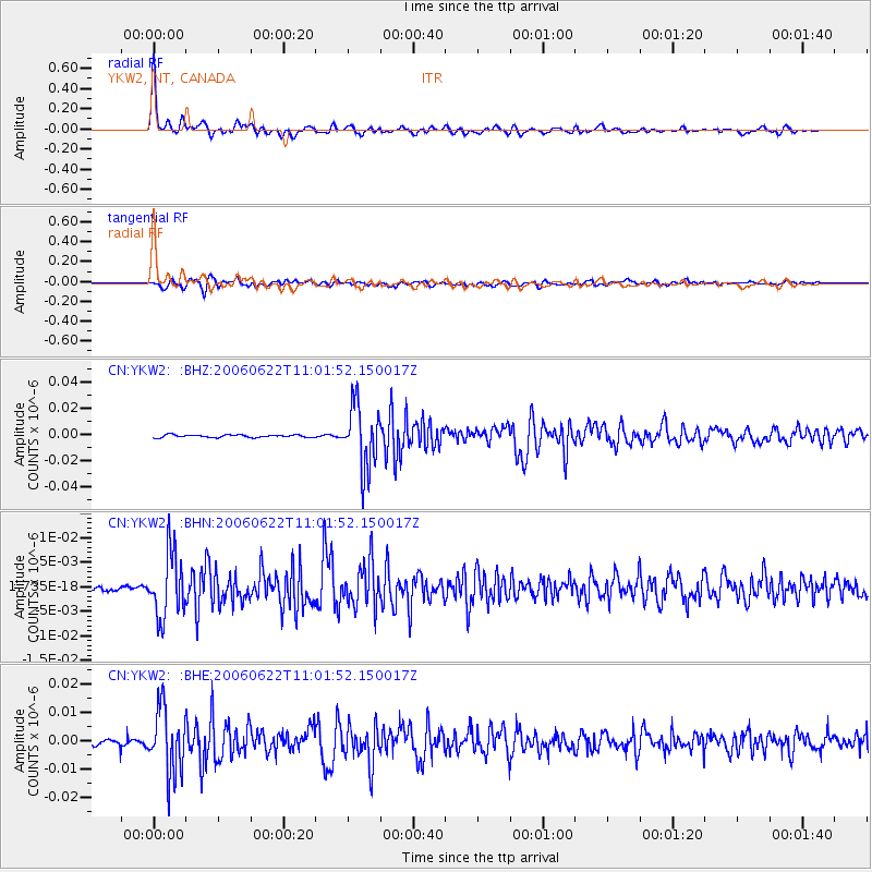
Signal To Noise
| Channel | StoN | STA | LTA |
| CN:YKW2: :BHN:20060622T11:01:52.150017Z | 7.8660493 | 6.550337E-9 | 8.327353E-10 |
| CN:YKW2: :BHE:20060622T11:01:52.150017Z | 9.057591 | 1.1471677E-8 | 1.2665261E-9 |
| CN:YKW2: :BHZ:20060622T11:01:52.150017Z | 23.364647 | 2.3614298E-8 | 1.0106851E-9 |
| Arrivals |
| Ps | 4.6 SECOND |
| PpPs | 15 SECOND |
| PsPs/PpSs | 20 SECOND |


