You are here: Home > Network List > IU - Global Seismograph Network (GSN - IRIS/USGS) Stations List
> Station RSSD Black Hills, South Dakota, USA > Earthquake Result Viewer
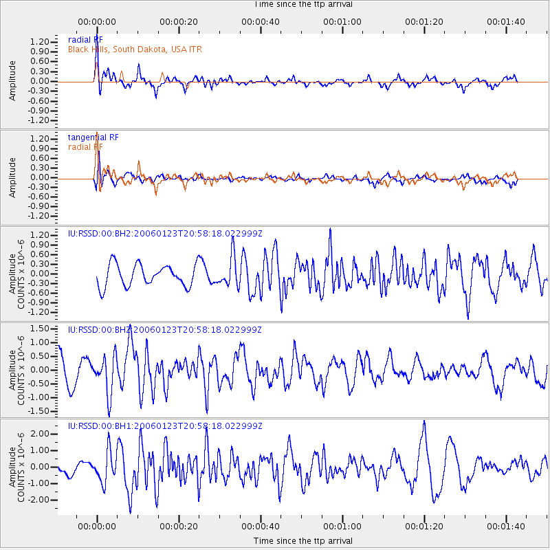
RSSD Black Hills, South Dakota, USA - Earthquake Result Viewer
*The percent match for this event was below the threshold and hence no stack was calculated.
| Earthquake location: |
Near West Coast Of Colombia |
| Earthquake latitude/longitude: |
6.9/-77.8 |
| Earthquake time(UTC): |
2006/01/23 (023) 20:50:44 GMT |
| Earthquake Depth: |
14 km |
| Earthquake Magnitude: |
6.1 MB, 5.9 MS, 6.2 MW, 6.1 MW |
| Earthquake Catalog/Contributor: |
WHDF/NEIC |
|
| Network: |
IU Global Seismograph Network (GSN - IRIS/USGS) |
| Station: |
RSSD Black Hills, South Dakota, USA |
| Lat/Lon: |
44.12 N/104.04 W |
| Elevation: |
2060 m |
|
| Distance: |
43.6 deg |
| Az: |
332.515 deg |
| Baz: |
140.485 deg |
| Ray Param: |
$rayparam |
*The percent match for this event was below the threshold and hence was not used in the summary stack. |
|
| Radial Match: |
65.717896 % |
| Radial Bump: |
359 |
| Transverse Match: |
68.69134 % |
| Transverse Bump: |
400 |
| SOD ConfigId: |
590571 |
| Insert Time: |
2013-09-25 18:53:53.009 +0000 |
| GWidth: |
2.5 |
| Max Bumps: |
400 |
| Tol: |
0.001 |
|
Signal To Noise
| Channel | StoN | STA | LTA |
| IU:RSSD:00:BHZ:20060123T20:58:18.022999Z | 1.6124586 | 6.8676206E-7 | 4.259099E-7 |
| IU:RSSD:00:BH1:20060123T20:58:18.022999Z | 1.5805255 | 9.357987E-7 | 5.920807E-7 |
| IU:RSSD:00:BH2:20060123T20:58:18.022999Z | 1.3959347 | 4.7090566E-7 | 3.3734074E-7 |
| Arrivals |
| Ps | |
| PpPs | |
| PsPs/PpSs | |


