MSEY Mahe, Seychelles - Earthquake Result Viewer
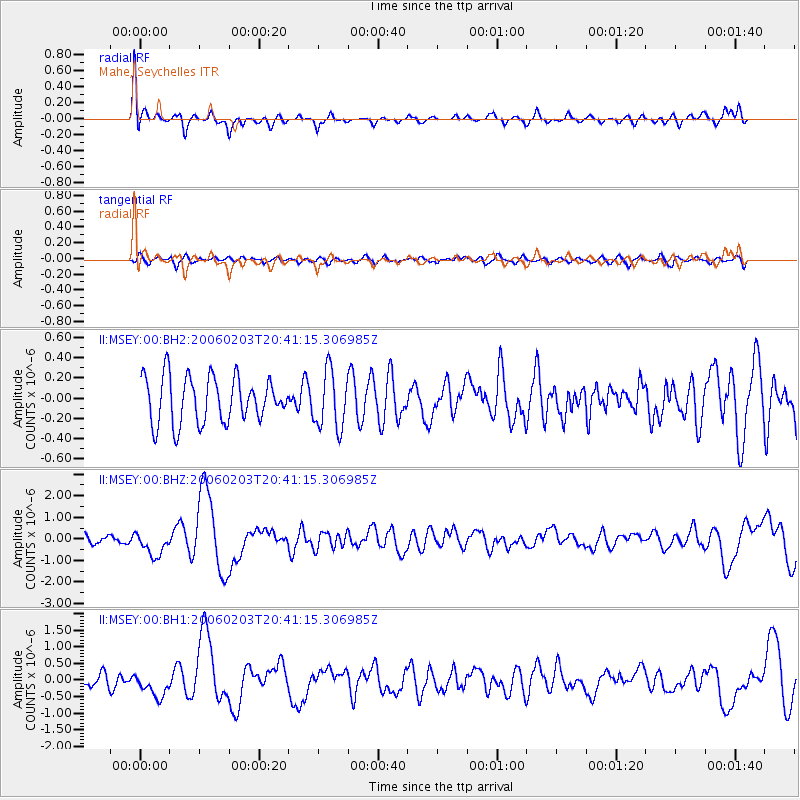
Earthquake location: Andaman Islands, India Region
Earthquake latitude/longitude: 11.9/92.4
Earthquake time(UTC): 2006/02/03 (034) 20:34:12 GMT
Earthquake Depth: 30 km
Earthquake Magnitude: 5.6 MB, 5.9 MS, 6.1 MW, 6.0 MW
Earthquake Catalog/Contributor: WHDF/NEIC
Network: II Global Seismograph Network (GSN - IRIS/IDA)
Station: MSEY Mahe, Seychelles
Lat/Lon: 4.67 S/55.48 E
Elevation: 475 m
Distance: 40.3 deg
Az: 247.957 deg
Baz: 65.535 deg
Ray Param: 0.07445289
Estimated Moho Depth: 17.5 km
Estimated Crust Vp/Vs: 1.61
Assumed Crust Vp: 6.303 km/s
Estimated Crust Vs: 3.921 km/s
Estimated Crust Poisson's Ratio: 0.18
Radial Match: 80.32868 %
Radial Bump: 400
Transverse Match: 55.519543 %
Transverse Bump: 400
SOD ConfigId: 590571
Insert Time: 2013-09-25 19:04:01.826 +0000
GWidth: 2.5
Max Bumps: 400
Tol: 0.001

Signal To Noise

ChannelStoNSTALTA
II:MSEY:00:BHZ:20060203T20:41:15.306985Z2.91029025.5624605E-71.9113078E-7
II:MSEY:00:BH1:20060203T20:41:15.306985Z2.02355123.633795E-71.7957515E-7
II:MSEY:00:BH2:20060203T20:41:15.306985Z1.39404963.0542853E-72.1909445E-7
Arrivals
Ps1.8 SECOND
PpPs6.7 SECOND
PsPs/PpSs8.5 SECOND