You are here: Home > Network List > IU - Global Seismograph Network (GSN - IRIS/USGS) Stations List
> Station PMG Port Moresby, New Guinea > Earthquake Result Viewer
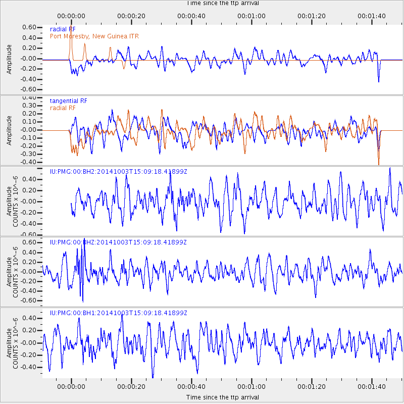
PMG Port Moresby, New Guinea - Earthquake Result Viewer
*The percent match for this event was below the threshold and hence no stack was calculated.
| Earthquake location: |
South Of Fiji Islands |
| Earthquake latitude/longitude: |
-23.4/-176.6 |
| Earthquake time(UTC): |
2014/10/03 (276) 15:02:44 GMT |
| Earthquake Depth: |
86 km |
| Earthquake Magnitude: |
4.9 mb |
| Earthquake Catalog/Contributor: |
ISC/ISC |
|
| Network: |
IU Global Seismograph Network (GSN - IRIS/USGS) |
| Station: |
PMG Port Moresby, New Guinea |
| Lat/Lon: |
9.40 S/147.16 E |
| Elevation: |
90 m |
|
| Distance: |
37.3 deg |
| Az: |
285.83 deg |
| Baz: |
116.419 deg |
| Ray Param: |
$rayparam |
*The percent match for this event was below the threshold and hence was not used in the summary stack. |
|
| Radial Match: |
42.004047 % |
| Radial Bump: |
400 |
| Transverse Match: |
43.86456 % |
| Transverse Bump: |
400 |
| SOD ConfigId: |
3390531 |
| Insert Time: |
2019-04-14 08:11:50.128 +0000 |
| GWidth: |
2.5 |
| Max Bumps: |
400 |
| Tol: |
0.001 |
|
Signal To Noise
| Channel | StoN | STA | LTA |
| IU:PMG:00:BHZ:20141003T15:09:18.41899Z | 2.5358732 | 3.1027895E-7 | 1.2235586E-7 |
| IU:PMG:00:BH1:20141003T15:09:18.41899Z | 0.7947471 | 1.617078E-7 | 2.0347076E-7 |
| IU:PMG:00:BH2:20141003T15:09:18.41899Z | 1.3055224 | 2.4123094E-7 | 1.847773E-7 |
| Arrivals |
| Ps | |
| PpPs | |
| PsPs/PpSs | |


