You are here: Home > Network List > IU - Global Seismograph Network (GSN - IRIS/USGS) Stations List
> Station RSSD Black Hills, South Dakota, USA > Earthquake Result Viewer
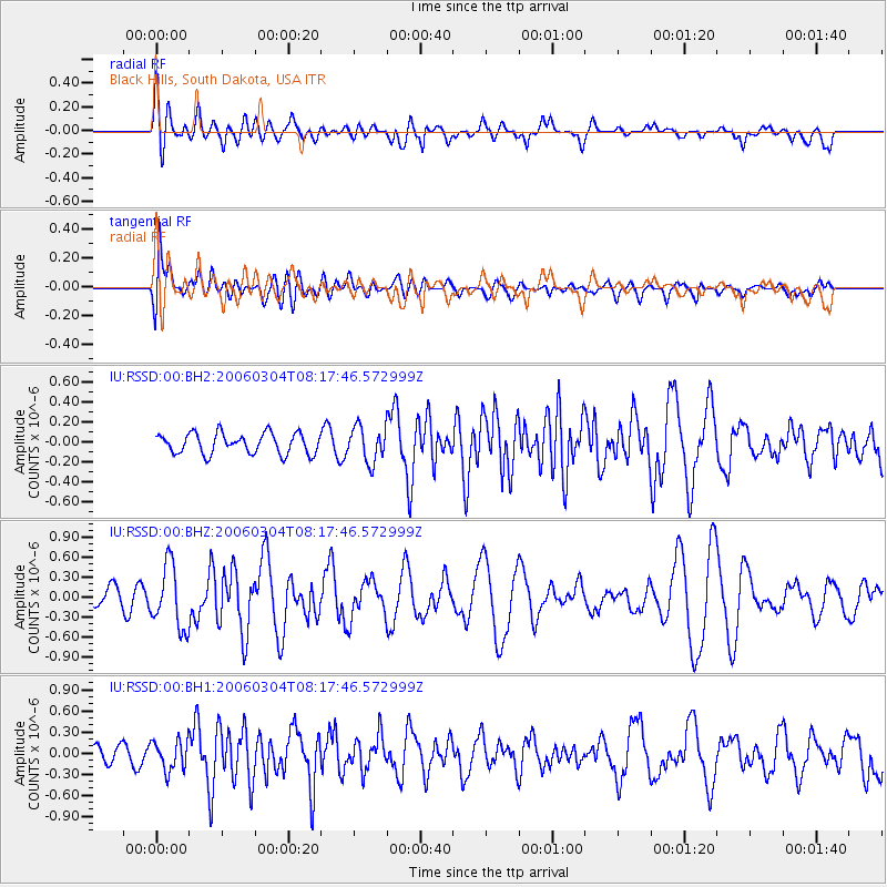
RSSD Black Hills, South Dakota, USA - Earthquake Result Viewer
*The percent match for this event was below the threshold and hence no stack was calculated.
| Earthquake location: |
Off Coast Of Central America |
| Earthquake latitude/longitude: |
12.6/-89.4 |
| Earthquake time(UTC): |
2006/03/04 (063) 08:11:37 GMT |
| Earthquake Depth: |
28 km |
| Earthquake Magnitude: |
5.4 MB, 4.8 MS, 5.7 MW, 5.4 MW |
| Earthquake Catalog/Contributor: |
WHDF/NEIC |
|
| Network: |
IU Global Seismograph Network (GSN - IRIS/USGS) |
| Station: |
RSSD Black Hills, South Dakota, USA |
| Lat/Lon: |
44.12 N/104.04 W |
| Elevation: |
2060 m |
|
| Distance: |
33.9 deg |
| Az: |
340.873 deg |
| Baz: |
153.632 deg |
| Ray Param: |
$rayparam |
*The percent match for this event was below the threshold and hence was not used in the summary stack. |
|
| Radial Match: |
49.178604 % |
| Radial Bump: |
400 |
| Transverse Match: |
69.62695 % |
| Transverse Bump: |
400 |
| SOD ConfigId: |
590571 |
| Insert Time: |
2013-09-25 19:29:48.266 +0000 |
| GWidth: |
2.5 |
| Max Bumps: |
400 |
| Tol: |
0.001 |
|
Signal To Noise
| Channel | StoN | STA | LTA |
| IU:RSSD:00:BHZ:20060304T08:17:46.572999Z | 2.8171299 | 4.776915E-7 | 1.6956673E-7 |
| IU:RSSD:00:BH1:20060304T08:17:46.572999Z | 1.1839154 | 2.1484846E-7 | 1.8147281E-7 |
| IU:RSSD:00:BH2:20060304T08:17:46.572999Z | 1.7134022 | 1.7648856E-7 | 1.03004744E-7 |
| Arrivals |
| Ps | |
| PpPs | |
| PsPs/PpSs | |


