You are here: Home > Network List > IU - Global Seismograph Network (GSN - IRIS/USGS) Stations List
> Station RSSD Black Hills, South Dakota, USA > Earthquake Result Viewer
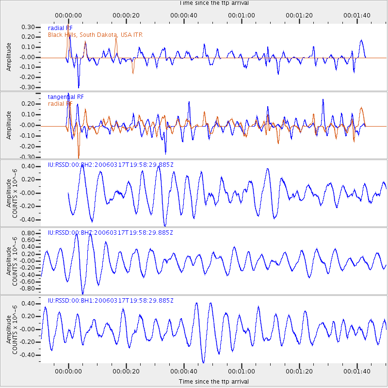
RSSD Black Hills, South Dakota, USA - Earthquake Result Viewer
*The percent match for this event was below the threshold and hence no stack was calculated.
| Earthquake location: |
Tonga Islands |
| Earthquake latitude/longitude: |
-15.3/-175.7 |
| Earthquake time(UTC): |
2006/03/17 (076) 19:46:11 GMT |
| Earthquake Depth: |
10 km |
| Earthquake Magnitude: |
5.6 MW, 5.3 MS, 5.2 MB, 5.6 MW |
| Earthquake Catalog/Contributor: |
WHDF/NEIC |
|
| Network: |
IU Global Seismograph Network (GSN - IRIS/USGS) |
| Station: |
RSSD Black Hills, South Dakota, USA |
| Lat/Lon: |
44.12 N/104.04 W |
| Elevation: |
2060 m |
|
| Distance: |
87.9 deg |
| Az: |
43.174 deg |
| Baz: |
246.443 deg |
| Ray Param: |
$rayparam |
*The percent match for this event was below the threshold and hence was not used in the summary stack. |
|
| Radial Match: |
67.90684 % |
| Radial Bump: |
400 |
| Transverse Match: |
69.32106 % |
| Transverse Bump: |
400 |
| SOD ConfigId: |
590571 |
| Insert Time: |
2013-09-25 19:45:32.996 +0000 |
| GWidth: |
2.5 |
| Max Bumps: |
400 |
| Tol: |
0.001 |
|
Signal To Noise
| Channel | StoN | STA | LTA |
| IU:RSSD:00:BHZ:20060317T19:58:29.885Z | 2.3711946 | 5.156403E-7 | 2.1746014E-7 |
| IU:RSSD:00:BH1:20060317T19:58:29.885Z | 0.8215736 | 1.3366446E-7 | 1.6269323E-7 |
| IU:RSSD:00:BH2:20060317T19:58:29.885Z | 1.4953682 | 3.0265483E-7 | 2.0239484E-7 |
| Arrivals |
| Ps | |
| PpPs | |
| PsPs/PpSs | |


