You are here: Home > Network List > TA - USArray Transportable Network (new EarthScope stations) Stations List
> Station J01E Myrtle Point, OR, USA > Earthquake Result Viewer
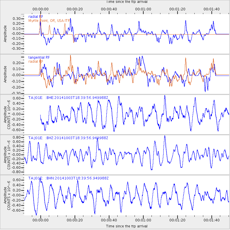
J01E Myrtle Point, OR, USA - Earthquake Result Viewer
*The percent match for this event was below the threshold and hence no stack was calculated.
| Earthquake location: |
Tonga Islands |
| Earthquake latitude/longitude: |
-21.0/-174.1 |
| Earthquake time(UTC): |
2014/10/03 (276) 18:28:25 GMT |
| Earthquake Depth: |
9.9 km |
| Earthquake Magnitude: |
5.2 MW |
| Earthquake Catalog/Contributor: |
ISC/ISC |
|
| Network: |
TA USArray Transportable Network (new EarthScope stations) |
| Station: |
J01E Myrtle Point, OR, USA |
| Lat/Lon: |
43.16 N/123.93 W |
| Elevation: |
128 m |
|
| Distance: |
78.8 deg |
| Az: |
34.952 deg |
| Baz: |
227.012 deg |
| Ray Param: |
$rayparam |
*The percent match for this event was below the threshold and hence was not used in the summary stack. |
|
| Radial Match: |
49.07117 % |
| Radial Bump: |
400 |
| Transverse Match: |
47.00908 % |
| Transverse Bump: |
400 |
| SOD ConfigId: |
3390531 |
| Insert Time: |
2019-04-14 08:20:53.782 +0000 |
| GWidth: |
2.5 |
| Max Bumps: |
400 |
| Tol: |
0.001 |
|
Signal To Noise
| Channel | StoN | STA | LTA |
| TA:J01E: :BHZ:20141003T18:39:56.949988Z | 1.1414791 | 3.1492945E-7 | 2.7589593E-7 |
| TA:J01E: :BHN:20141003T18:39:56.949988Z | 1.7510028 | 4.365335E-7 | 2.4930486E-7 |
| TA:J01E: :BHE:20141003T18:39:56.949988Z | 1.5008812 | 3.5186778E-7 | 2.3444079E-7 |
| Arrivals |
| Ps | |
| PpPs | |
| PsPs/PpSs | |


