You are here: Home > Network List > IU - Global Seismograph Network (GSN - IRIS/USGS) Stations List
> Station RSSD Black Hills, South Dakota, USA > Earthquake Result Viewer
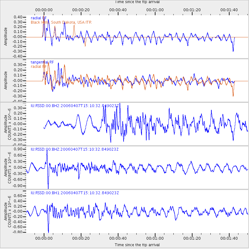
RSSD Black Hills, South Dakota, USA - Earthquake Result Viewer
*The percent match for this event was below the threshold and hence no stack was calculated.
| Earthquake location: |
East Of Kuril Islands |
| Earthquake latitude/longitude: |
44.9/150.4 |
| Earthquake time(UTC): |
2006/04/07 (097) 15:00:02 GMT |
| Earthquake Depth: |
65 km |
| Earthquake Magnitude: |
5.5 MB, 5.5 MW, 5.3 MW |
| Earthquake Catalog/Contributor: |
WHDF/NEIC |
|
| Network: |
IU Global Seismograph Network (GSN - IRIS/USGS) |
| Station: |
RSSD Black Hills, South Dakota, USA |
| Lat/Lon: |
44.12 N/104.04 W |
| Elevation: |
2060 m |
|
| Distance: |
69.5 deg |
| Az: |
47.785 deg |
| Baz: |
313.021 deg |
| Ray Param: |
$rayparam |
*The percent match for this event was below the threshold and hence was not used in the summary stack. |
|
| Radial Match: |
47.2397 % |
| Radial Bump: |
400 |
| Transverse Match: |
53.57603 % |
| Transverse Bump: |
400 |
| SOD ConfigId: |
590571 |
| Insert Time: |
2013-09-25 20:12:16.898 +0000 |
| GWidth: |
2.5 |
| Max Bumps: |
400 |
| Tol: |
0.001 |
|
Signal To Noise
| Channel | StoN | STA | LTA |
| IU:RSSD:00:BHZ:20060407T15:10:32.849023Z | 3.005585 | 3.6725572E-7 | 1.221911E-7 |
| IU:RSSD:00:BH1:20060407T15:10:32.849023Z | 1.8528032 | 2.5290996E-7 | 1.3650126E-7 |
| IU:RSSD:00:BH2:20060407T15:10:32.849023Z | 1.9192296 | 1.4824268E-7 | 7.724072E-8 |
| Arrivals |
| Ps | |
| PpPs | |
| PsPs/PpSs | |


