You are here: Home > Network List > AV - Alaska Volcano Observatory Stations List
> Station MAPS Pakushin Southeast, Makushin Volcano, Alaska > Earthquake Result Viewer
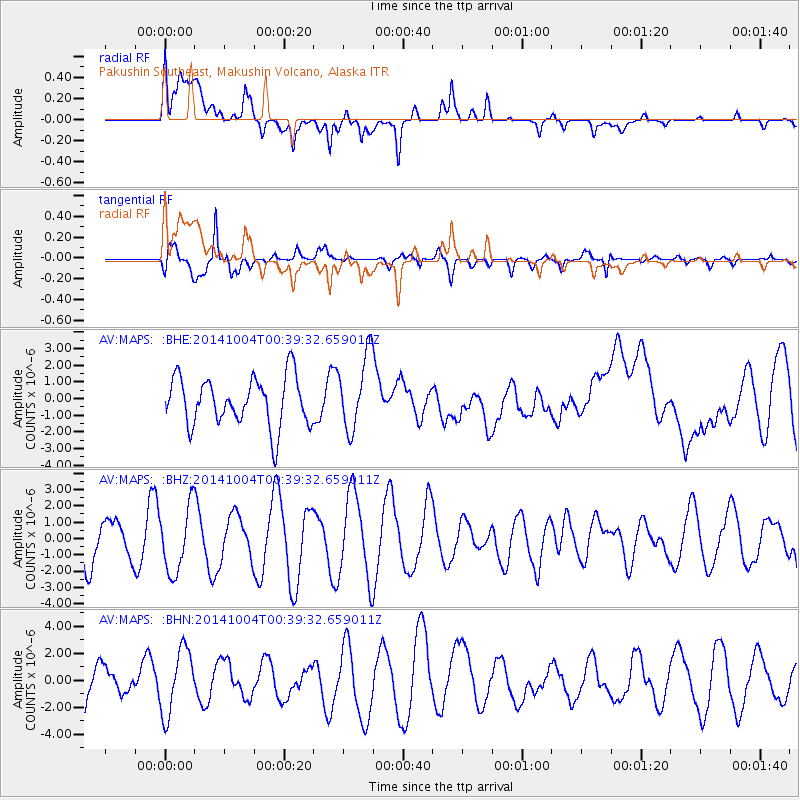
MAPS Pakushin Southeast, Makushin Volcano, Alaska - Earthquake Result Viewer
*The percent match for this event was below the threshold and hence no stack was calculated.
| Earthquake location: |
Kuril Islands |
| Earthquake latitude/longitude: |
44.5/148.0 |
| Earthquake time(UTC): |
2014/10/04 (277) 00:33:59 GMT |
| Earthquake Depth: |
99 km |
| Earthquake Magnitude: |
4.9 MW |
| Earthquake Catalog/Contributor: |
ISC/ISC |
|
| Network: |
AV Alaska Volcano Observatory |
| Station: |
MAPS Pakushin Southeast, Makushin Volcano, Alaska |
| Lat/Lon: |
53.81 N/166.94 W |
| Elevation: |
333 m |
|
| Distance: |
30.4 deg |
| Az: |
55.996 deg |
| Baz: |
270.854 deg |
| Ray Param: |
$rayparam |
*The percent match for this event was below the threshold and hence was not used in the summary stack. |
|
| Radial Match: |
55.008846 % |
| Radial Bump: |
400 |
| Transverse Match: |
85.53948 % |
| Transverse Bump: |
400 |
| SOD ConfigId: |
3390531 |
| Insert Time: |
2019-04-14 08:24:29.806 +0000 |
| GWidth: |
2.5 |
| Max Bumps: |
400 |
| Tol: |
0.001 |
|
Signal To Noise
| Channel | StoN | STA | LTA |
| AV:MAPS: :BHZ:20141004T00:39:32.659011Z | 1.4871843 | 2.0218479E-6 | 1.359514E-6 |
| AV:MAPS: :BHN:20141004T00:39:32.659011Z | 2.583247 | 2.4174765E-6 | 9.358287E-7 |
| AV:MAPS: :BHE:20141004T00:39:32.659011Z | 1.5501869 | 2.268569E-6 | 1.4634164E-6 |
| Arrivals |
| Ps | |
| PpPs | |
| PsPs/PpSs | |


